1st – 8th June | Bukhara to Samarkand | Distance: 271km | Total Distance: 4615km
Arriving in Bukhara, there was a sense of what it was like arriving as a Silk Road traveller who had endured crossing the desert from Merv – Cycling from Merv, I had been going pretty hard in the heat and needed a few days to recuperate.
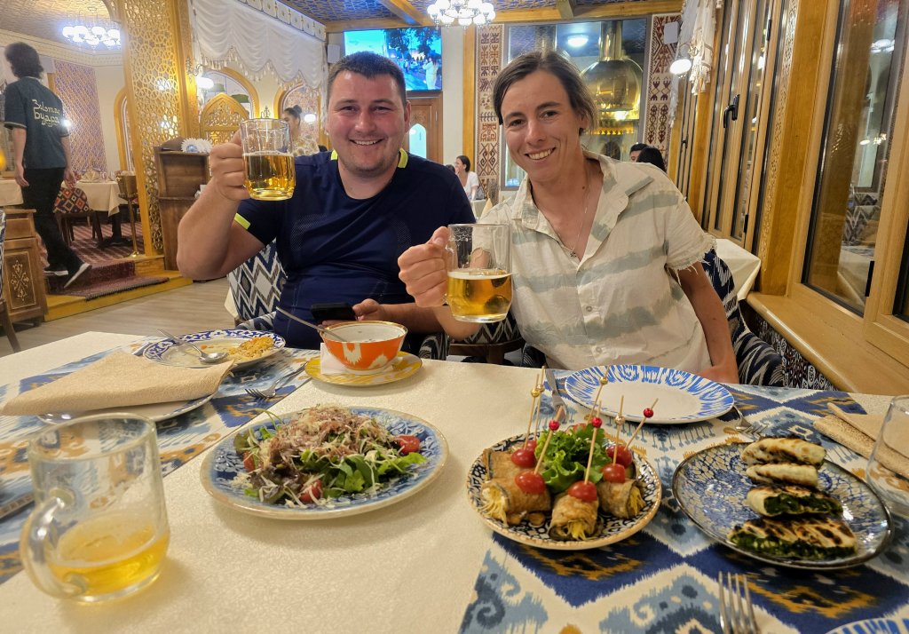
Sasha and Anna in our favourite restaurant – some time to relax
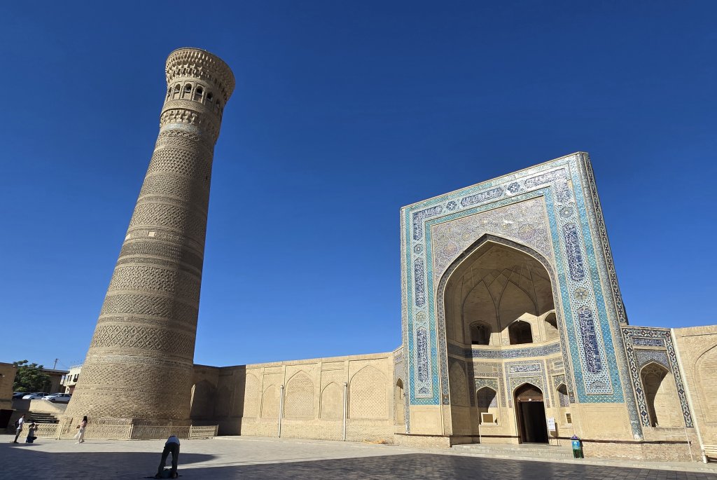
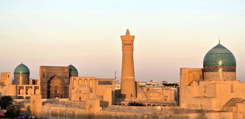
I was immediately captivated by Bukhara; I had booked a guesthouse in the old city. From the rooftop of the guesthouse, where breakfast was served, we could see the Kalon Minaret and several of the madrasas’s blue domes towering above a sea of roofs. Just outside the front door was the dome-roofed bazaar. It was just a short wander through the bazaar and along the cobblestoned street to the restaurants, traditional craft workshops and sellers, more shops and historical, well-preserved madrasahs. It was touristy, and sellers definitely were keen to sell their wares, but they weren’t too pushy, and refreshingly more reserved than in many places I have been. There was one particular restaurant that served excellent food and they got to know us pretty well during our three day stay. (I had planned to stay two days but, as I had an extra day up my sleeve, and we were comfortable, I thought it a good opportunity to take it in Bukhara). There is far too much history dating back 2500 years to do justice to in this blog, so here are a few images to give a feel for the place and encourage readers to find out more.
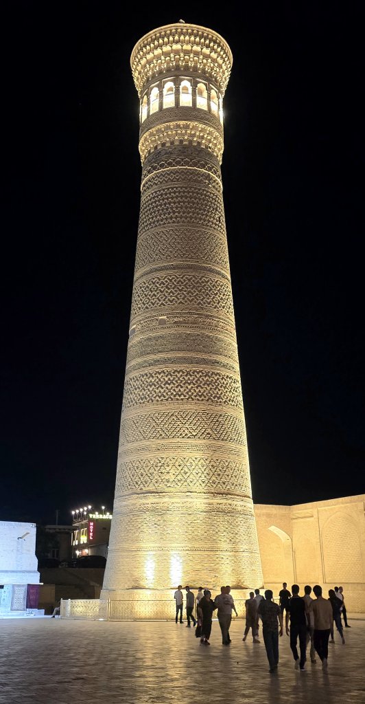
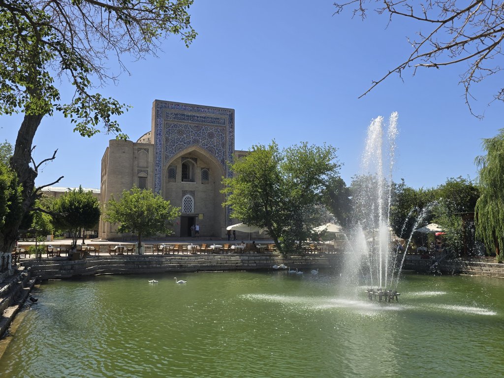
Kalon Minaret is inspiring day and night. Temperatures were hovering between 36C and 41C during the day, but the streets were a buzz in the eveningsKalon Minaret and Madrasah (Place of learning)The Lyabi Hauz Square is centred on an artificial reservoir (hauz) constructed in around 1620. It was the largest of the city reservoirs, fed directly from the main canal or Shah Rud (Royal Canal) which still bisects the old town. It was built with stone steps to allow the city’s water carriers to easily fill their leather buckets, regardless of the reservoir’s current water level. During the time of the emirate, the hauz was a stagnant water supply infested with a variety of waterborne diseases until the Soviets drained, restored and refilled it in the 1960s. The mulberry trees that line its shore date from 1477.
Bukhara was a time to catch up on many fronts and absorb the atmosphere. Anna and I filmed the key sites and interviewed some of the sellers.
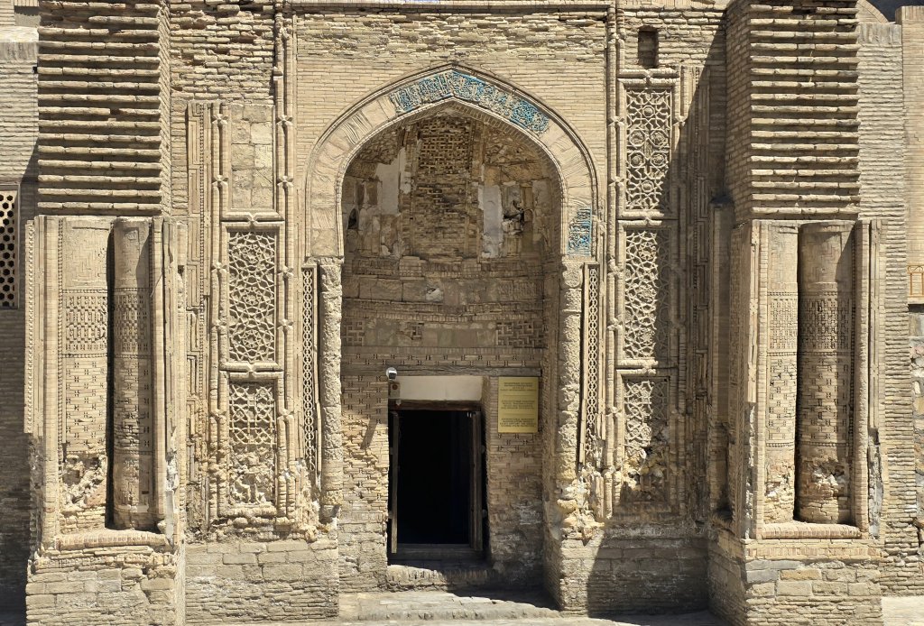
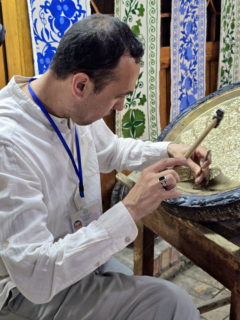
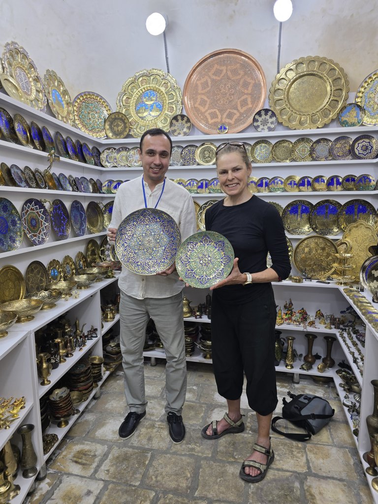
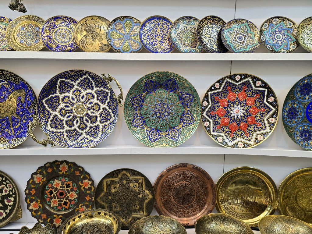
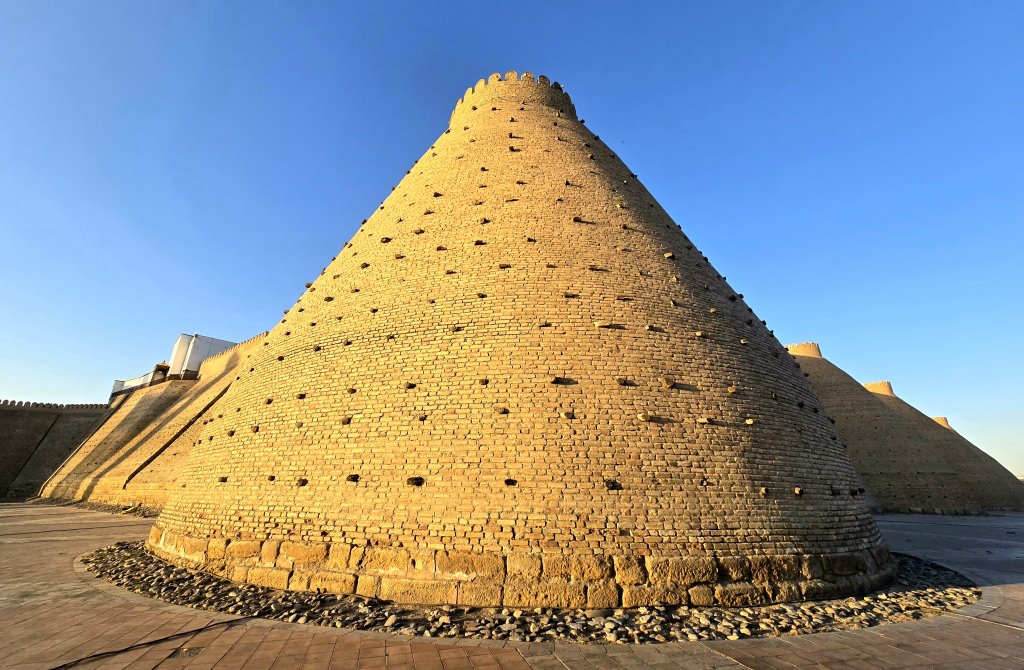
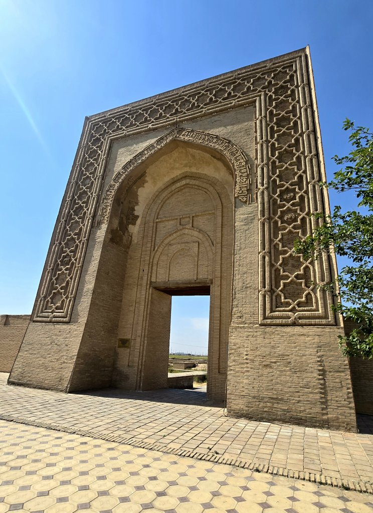
Anvar is a master metal engraver who’s traditional craft dates back to the 1600s. He spoke of his heritage and his fine work with pride and passion. He is foremost an artist and believes (as I do) that if you can strive to produce every work to the highest quality, the business will take care of itself. He is currently commissioned to make the finest of plates for museums and collections around the worldI loved the green plate I am holding but it was out of my price rangeThe “Ark” – built sometime between the 5th and 6th centuries CE, the Ark’s original rectangular structure included a palace, administrative areas, guardrooms, and a Zoroastrian fire temple. It became the centre around which the town of Bukhara was built with the main functions of the town taking place within its old wallsA view of the old city from the Ark’s fortress walls at sunset
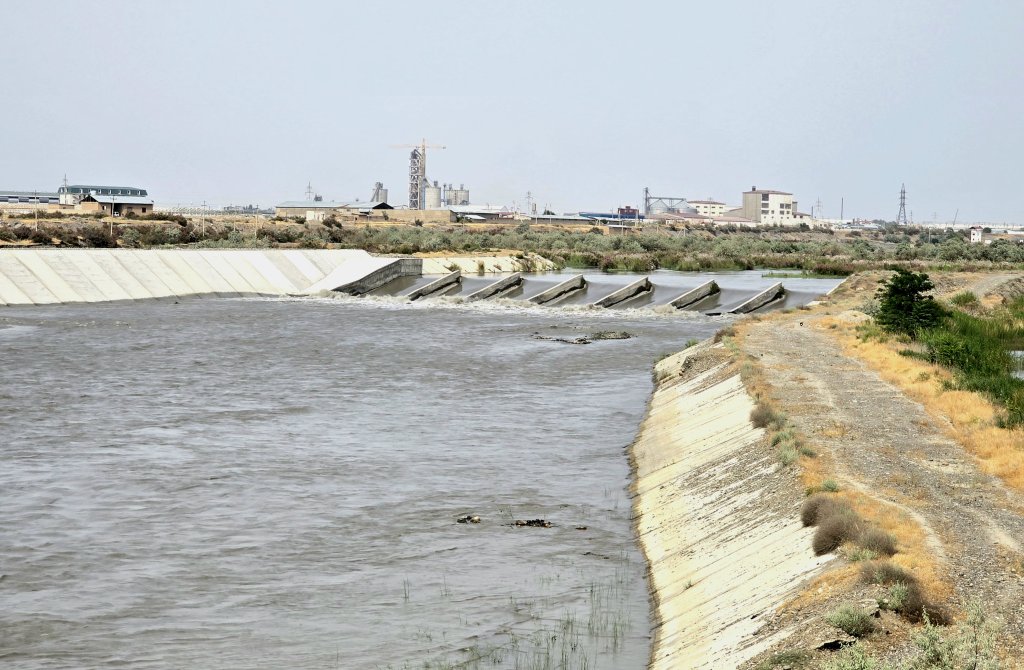
It was just 271km to Samarkand from Bukhara and I decided to break the distance into three days so we had time to see some of the sights. Away from the Bukhara oasis, the Zerafshan’s waters form a prosperous green strip through the desert – I generally tried to keep to the green, cycling from village to village.
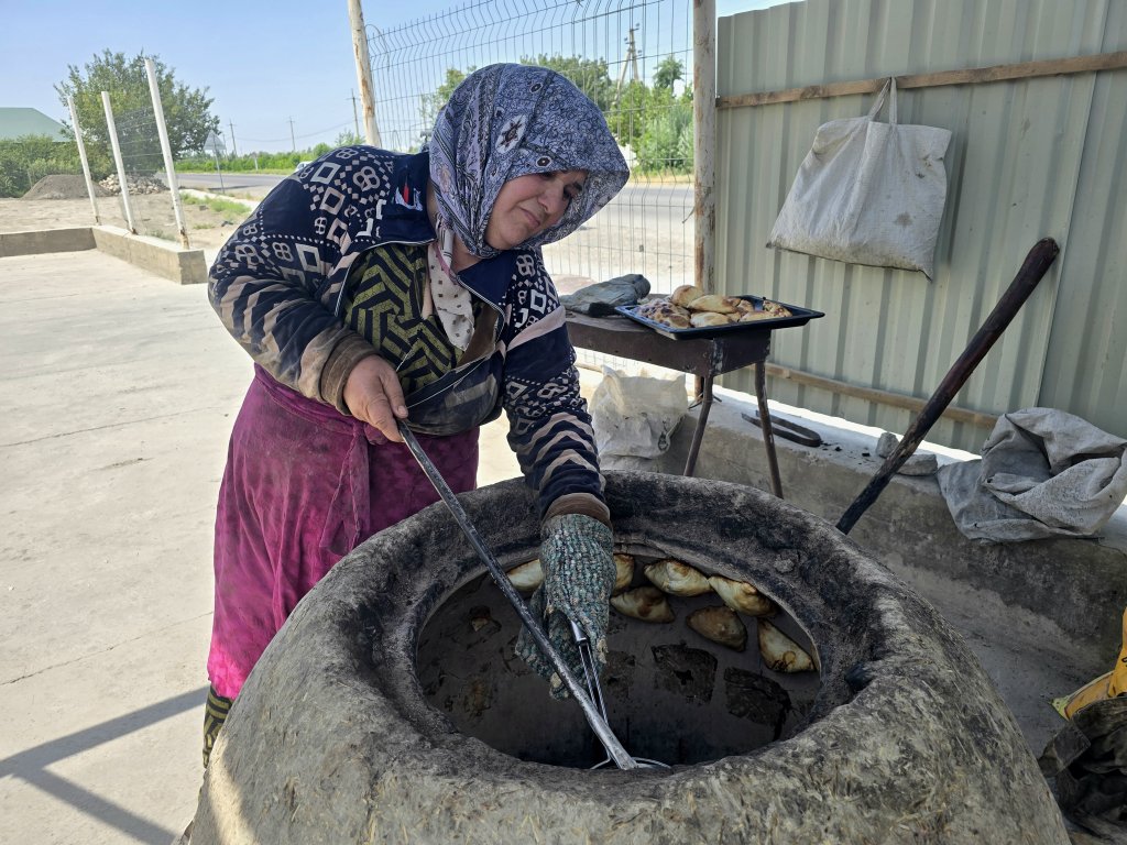
Making somsas using a traditional oven. (rest stop after the first 40km)
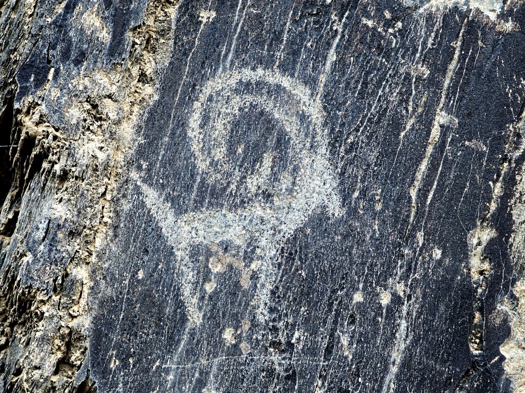
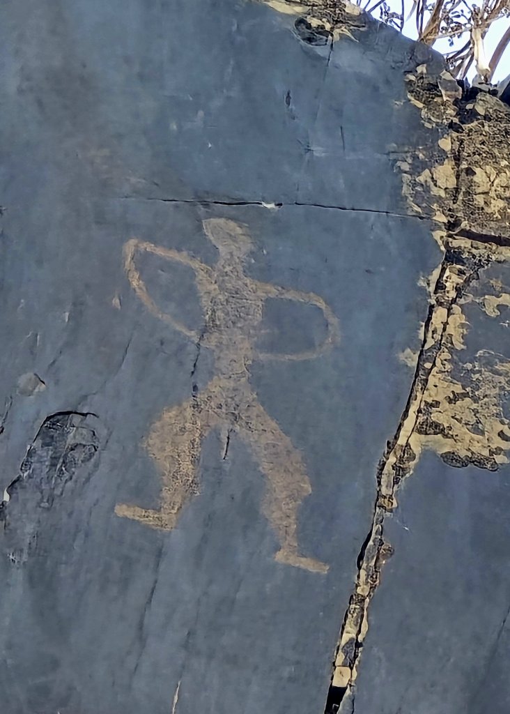
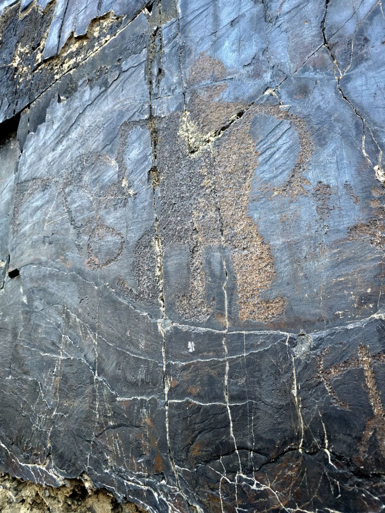
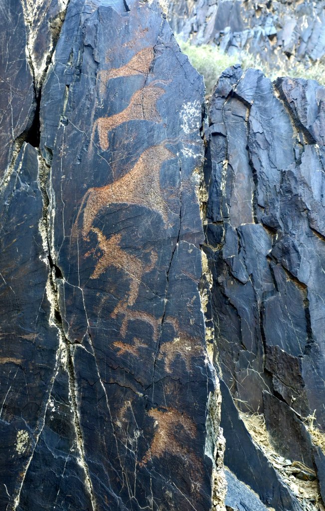
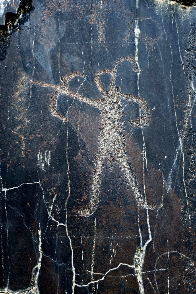
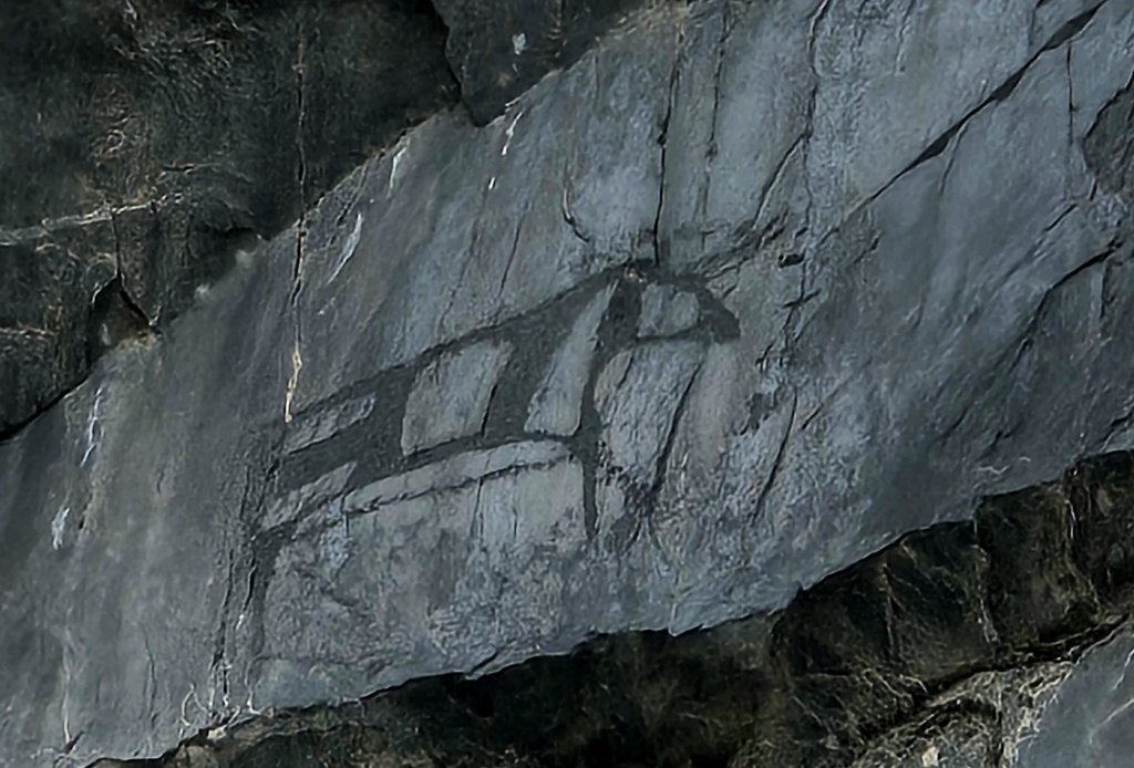
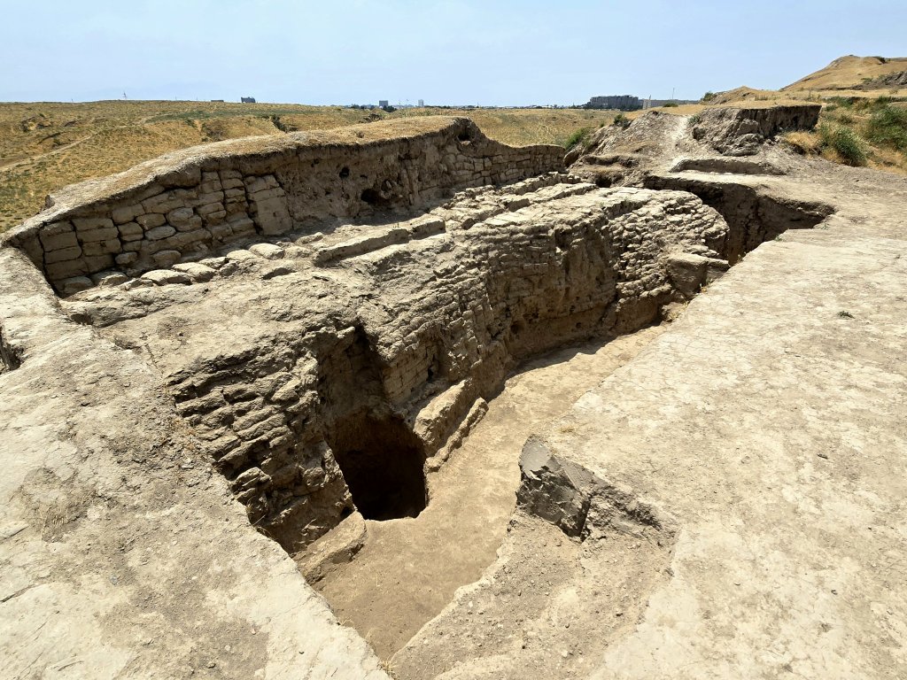
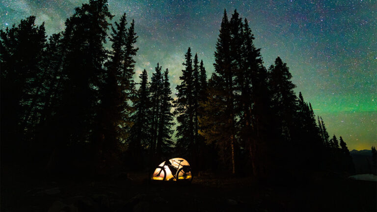
We wanted to camp but the area beside the river was too crowded with farming activity. Once I reached Karmana town, we packed the bike and drove to the nearby mountains to see the Sarmyshsay Petroglyphs. These are not listed as part of the Zerafshan-Karakum Corridor, but they show that this region was central to early humans long before communities settled beside the Zerafshan River.
Sarmyshsay is home to approximately 10,000 petroglyphs, with the majority dating back to the Bronze Age (3000-900 BCE). However, some of the images trace their origins to the Stone Age, starting from the 9th millennium BCE. These petroglyphs provide invaluable insights into the lives of ancient peoples, depicting scenes of hunting, dancing, and ritualistic activities. The exact dating of these images remains a complex task, requiring the analysis of various factors such as carving techniques, subject matter, and the presence of pigments. We spent the late afternoon clambering over the walls of the rocky gorge in search of the petroglyphs. Here are a few.
5th June: Karmana to Kattakurgen – 84km
I just had 80km and 84km to do on the second and third days into Samarkand, so I could take my time. Just as well because I was dealing with 39C on Day 2. I tried to take an alternative route from the main highway to see and follow a part of the Zerafshan River, but the bridge was closed and it was impossible to get to the river. On Day 3 when I wanted to cross, it appeared that the Zerafshan River on this the middle stage of its journey, was totally managed into canals – the river was no longer free to flow its natural course.
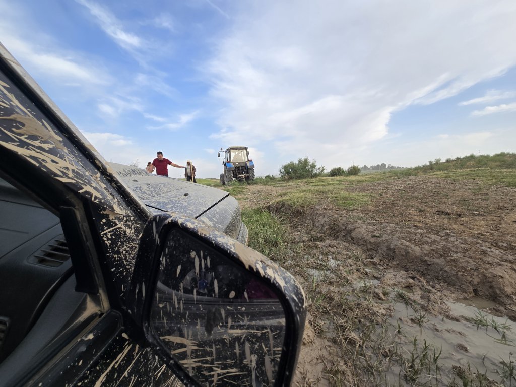
Again trying to camp away from the built up region around the main road, Sasha and Anna came up with the idea of camping beside a reservoir. Sasha decided to take a short cut to the shore of the lake, a cross country excursion, and became bogged..
A local farmer pulls Sasha’s car with his tractor
6th June: Kattakurgen to Samarkand – 83km
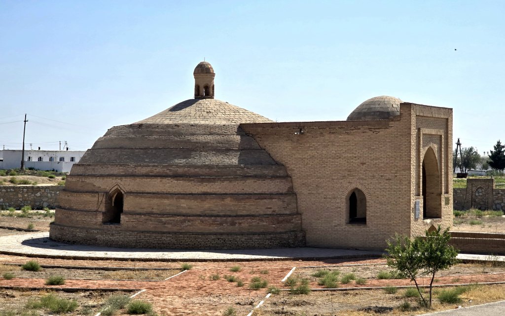
One of the highlights on the final day into Samarkand was seeing some of the lesser-known sites that make up the Zerafshan-Karakum Corridor such as:
Rabat-i-Malik – a caravanseraiSardoba Malik Reservoir – a cistern that supplied water to anyone passing along the Silk Roads
Samarkand
Samarkand is a very different city to Bukhara. Situated near to the mountains, the climate is slightly cooler and the city is very green.Its also a much bigger city with many of the historical buildings scattered around the city centre. We stayed near the city centre, but unlike Bukhara or Khiva, the sites were quite spread out and it required a lot more planning to access each site.
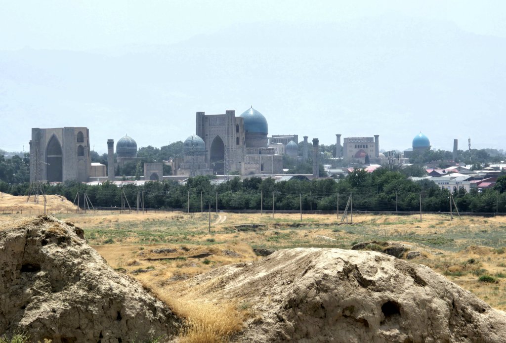
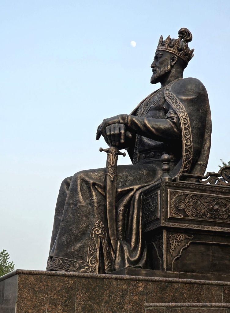
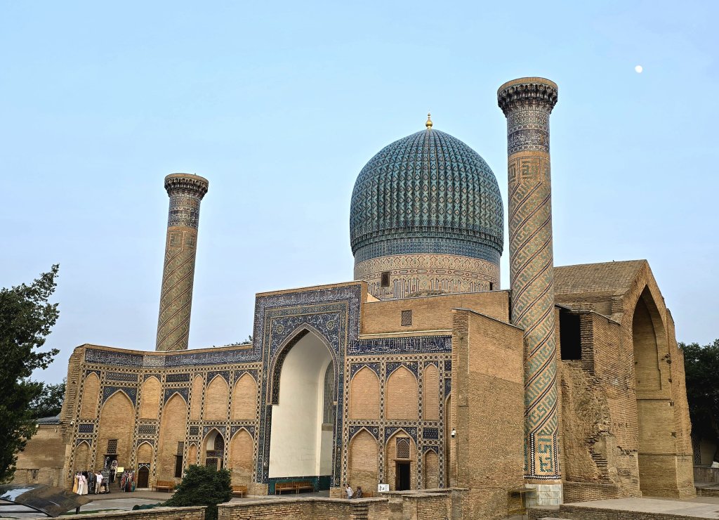
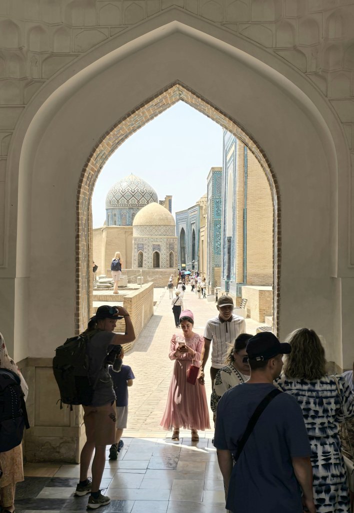
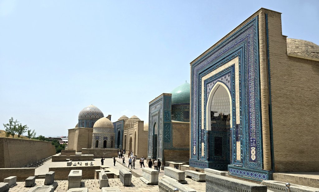
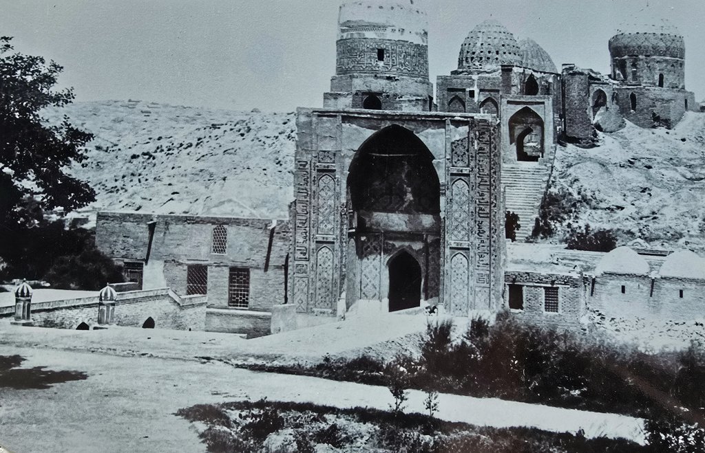
The first Samakand – Afrasiab. Founded in the 7th century B.C., Afrasiab was the main city of Sogdiana, an ancient region of Central Asia that stretched from the Amu Darya to the Syr Darya (rivers). This civilisation peaked in the 5th to 8th century CE Afrasiab was a territory of battles and conquests for many years. It was conquered by different empires, including by Alexander the Great in 329 BCE. In the 8th century, it was conquered by the Arabs and in the 13th century, Samarkand was almost entirely destroyed by Genghis Khan during the Mongolian invasionA view of Timur’s Samarkand from the ruins of Afrasiab, the “first Samarkand”The Zerafshan River on the industrial outskirts of Samarkand. Most major cities around the world make their rivers a central feature, but not Samarkand. The Zerafshan would have been close to Afrasiab and the Sogdians harnessed its water for their extensive canal and irrigation systemsAmir Temur (Tamerlane)The Gur-e Amir Complex is a striking madrasah that houses the tombs of Amir Temur and his beloved descendants. Temur died suddenly in Ottrar, Kazakhstan in 1405 (I visited the site where he died earlier in the journey) and was originally meant to be buried in his hometown of Shakhrisabz. However, his body was laid to rest at Gur-e Amir after they could not transport his body over the mountain pass that was blocked by snowThe name Shah-i-Zinda translates to “Tomb of the Living King” which refers to the holiest of the shrines, what is likely the grave of Qusam ibn-Abbas. He is famed for bringing Islam to this region in the 7th century. The mausoleums here were built over the periods of the 11th to the 19th centuries as Timur and Ulugbek buried their families and closest confidants here at later datesShah-i-Zinda before it was renovated
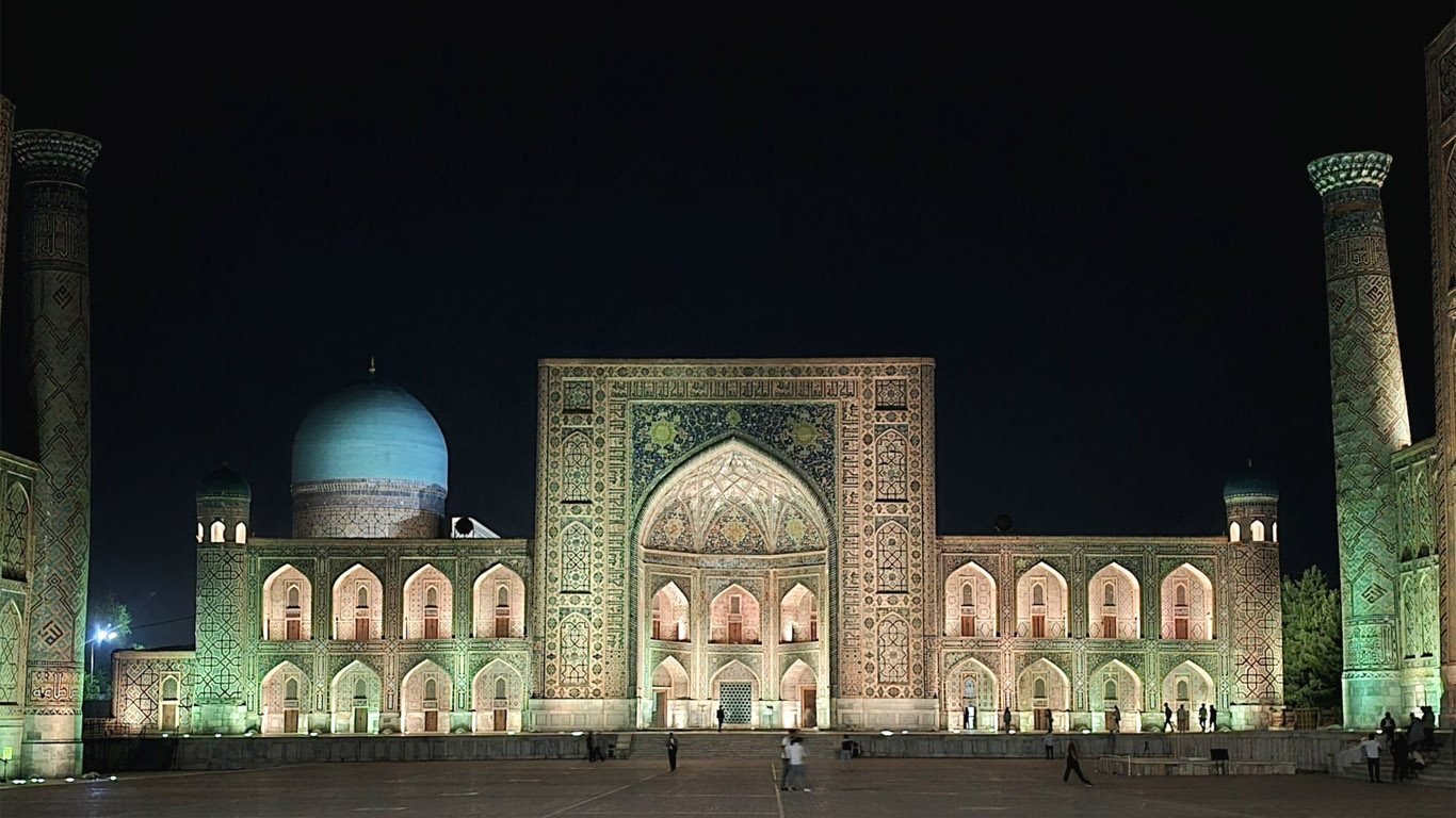
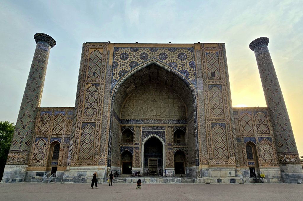
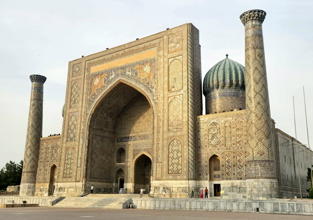
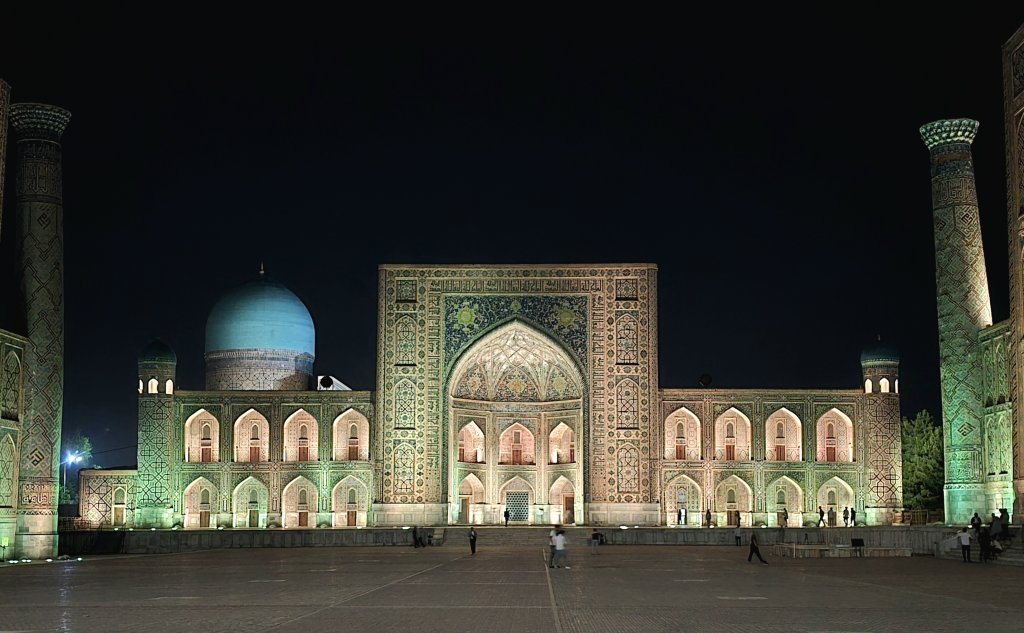
At the heart of Samarkand is the Registan, where three grand madrasahs — Ulugbek, Tilya-Kori, and Sher-Dor — showcase the grandeur of Timurid architecture. Each madrasah is adorned with intricate tilework, geometric patterns, and towering minarets.
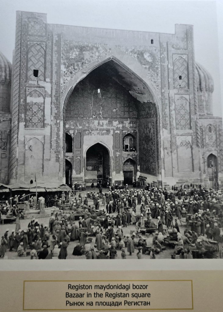
The name “Registan” translates to “sandy place” in Persian, reflecting the square’s origins as a bustling marketplace in the midst of the city’s desert surroundings. The square has been a hub of activity since the 15th century, witnessing academic gatherings, royal ceremonies and public events and even executions.
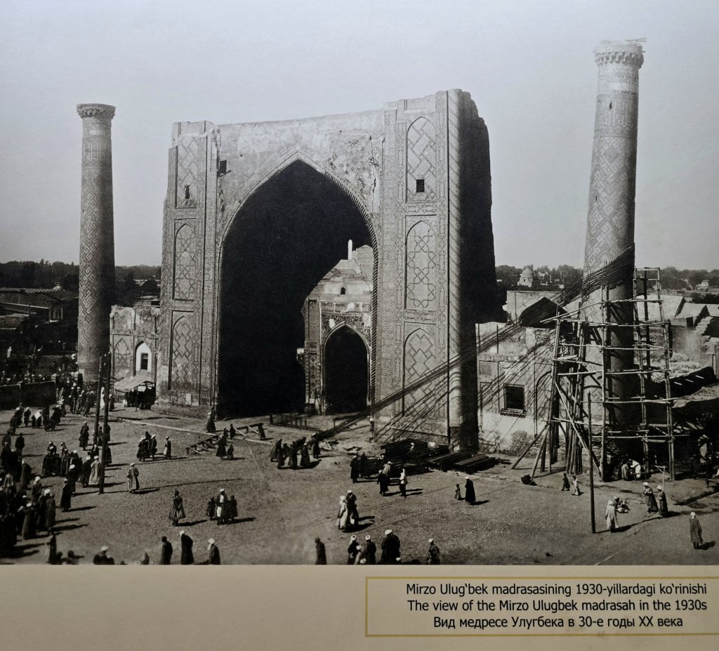
The oldest of the three structures, the Ulughbek Madrasa, was built between 1417 and 1420 under the rule of Mirzo Ulugbek, the brilliant grandson of Amir Temur. Unlike his militaristic ancestors, Ulughbek was a scholar, astronomer, and mathematician — a ruler who believed that knowledge was the path to power. His madrasah offered not only Islamic education but also served as a vibrant intellectual hub, where students gathered to study astronomy, geometry, philosophy, and the natural sciencesRestoration and Revival of the Registan By the 19th century, the Registan had suffered the ravages of time and several devastating earthquakes. Russian architects began initial restoration work during the imperial period, but it was in the Soviet era that large-scale preservation efforts were undertaken, saving the Registan from collapse. Craftsmen painstakingly replaced broken tiles using traditional methods, reinforced domes with hidden steel frameworks, and rebalanced crumbling foundations. Today, modern conservation continues, with a focus on maintaining historical integrity while preserving the structural safety of the buildings. Thanks to these efforts, the Registan is no longer a ruin — it is a revived cultural icon, once again alive with light, music, and human presence. It is the jewell in Uzbekistan’s cultureSher-Dor Madrasa Two centuries later, the Registan was expanded with the construction of the Sher-Dor Madrasa, completed in 1636 during the reign of Yalangtush Bahadur. In stark contrast to the intellectual tranquility of Ulugbek’s time, this madrasa exudes boldness and ambition. Its name, Sher-Dor, means “lion-bearing,” and its façade is perhaps the most enigmatic of the three. The most intriguing aspect of this madrasa is its massive portal, adorned with two roaring, mythical beasts — half lion, as indicated by their flowing manes, and half tiger, marked by their bold stripes — each bearing a radiant sun upon its back and depicted in pursuit of a fleeing, mystical deerTilya-Kori Madrasa (at night) Completing the trio is the Tilya-Kori Madrasah, constructed between 1646 and 1660. Its name means “gilded” or “decorated with gold,” and upon entering the prayer hall, its easy to understand why. Tilya-Kori functioned as both a madrasa and the main Friday mosque of SamarkandThe archive images are photos that I took at an education exhibition inside Ulugbek Madrassah
There is so much more that I don’t have time to write about in this blog. We had to continue along the Zerafshan-Karakum Corridor, and follow the string of historic sites into the mountains, along the Zerafshan Valley in Tajikistan and ultimately to the first/last site in the Zerafshan-Karakum Corridor, Khisorak Settlement.
Stay tuned for the final instalment of the Zerafshan-Karakum Corridor…
FOLLOW THE JOURNEY
Thanks to ZeroeSixZero, you can open this link on your phone and select “add to home screen” and the map will become and app. You can then keep updated in real time.
TAKE ACTION
Support my Water.org fundraiser to help bring safe drinking water and sanitation to the world: Just $5 (USD) provides someone with safe drinking water or access to sanitation, and every $5 donated to my fundraiser will enter the donor into the Breaking the Cycle Prize Draw.
EDUCATION
An education programme in partnership with Exploring by the Seat of Your Pants, with contributions from The Royal Geographical Society and The Duke of Edinburgh’s International Award Australia. We have created a Story Map resource to anchor the programme where presentations and updates will be added as we go.
Share your love
Kate Leeming
Explorer/adventurer. Kate has cycled a distance greater than twice around the world at the Equator. In the early ’90s when she rode a total of 15,000 km as her way of experiencing Europe, Kate developed her passion for travelling by bicycle. Since then, Kate has stepped it up, performing three major expeditions: the Trans-Siberian Cycle Expedition from St. Petersburg to Vladivostok, the Great Australian Cycle Expedition with Greg Yeoman and the Breaking the Cycle in Africa expedition from Senegal to Somalia. Her next venture is Breaking the Cycle South Pole, which will be the first bicycle crossing of the Antarctic continent via the South Pole. She is preparing for this challenge with expeditions (polar, sand, altitude) on six continents.