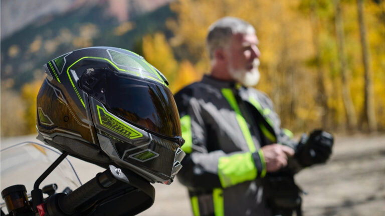
10th – 12th August | Ishkashim to Sarhad e Broghil (Wakhan Corridor, Afghanistan) | Distance: 194km | Total Distance: 8881km
Ishkashim is the gateway to the Wakhan Corridor and the Afghan Pamir. It has a real “frontier town” atmosphere. The bazaar was buzzing. It is the last place with easy road access to the rest of Afghanistan to the west and a regional centre for those who live further east along the Wakhan Corridor. I hoped to have a rest day in Ishkashim to prepare for the remote journey ahead and catch up on sleep and writing. However, as we lost a day because of the time taken to get permits in Faizabad, I could not afford a day off and expect to finish the expedition and return to Tajikistan on time. As a result, getting supplies for the rest of the journey ended up being a mad shopping spree just after we arrived in Ishkashim where it was difficult to get a handle on what we needed and what was available. Normally I would have a considered plan with lists of what we would need. We ended up buying way too much and missed out on some essentials.
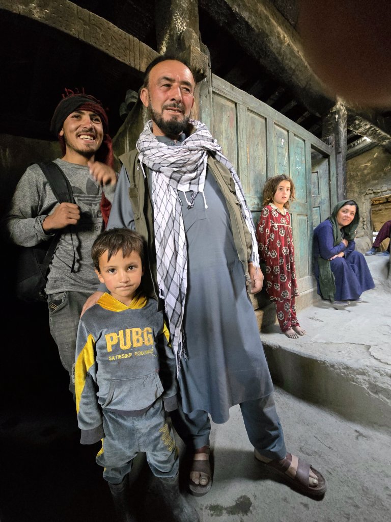
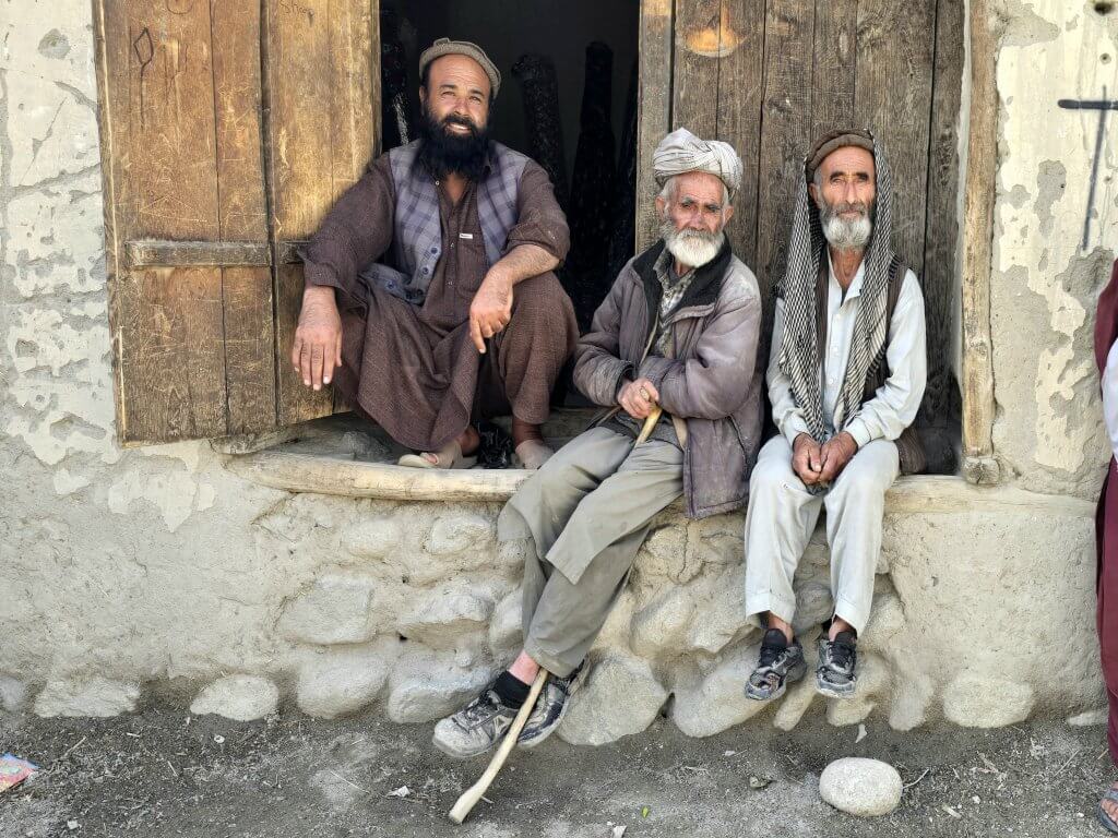
Our guide for the second half of our time in Afghanistan was Malang Darya, one of the most experienced in the region, best known for being the first Afghani to climb Afghanistan’s highest peak, Mount Noshaq (7492m), a feat he did without oxygen.
Malang Darya, a proud Wakhi man, at home with a grandson, a nephew and two other family members
The next section of the journey, about 200km from Ishkashim to Sarhad e Broghil, I’d hoped to cover in two long days. Knowing the conditions I would face, although not knowing so much about what it would be like to cycle it, Malang and Azim thought it would take me three days. I was just going to give it my best shot and see how I went.
Day 140 | 10th August | Ishkashim to Khandud – 83km
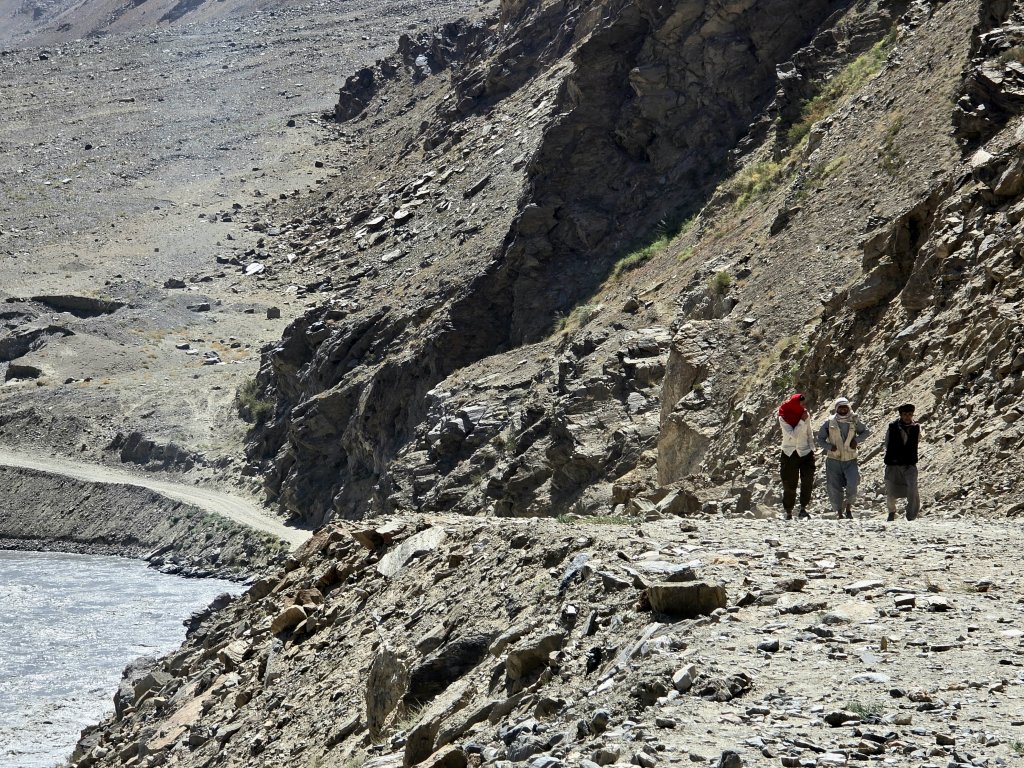
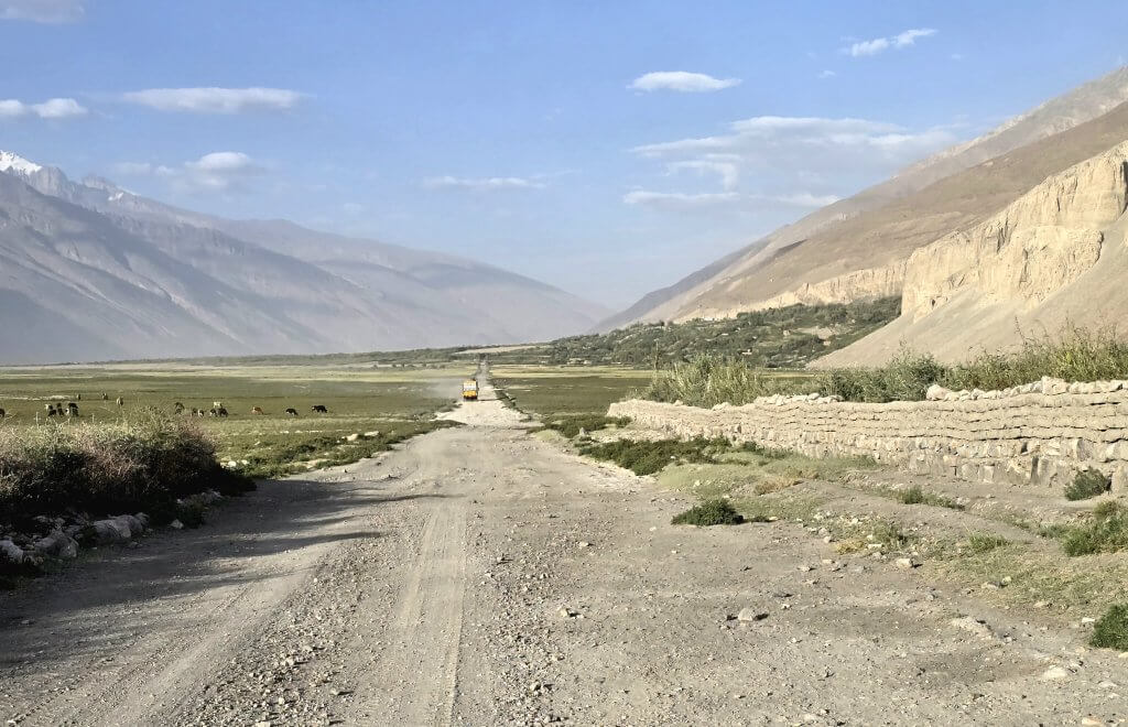
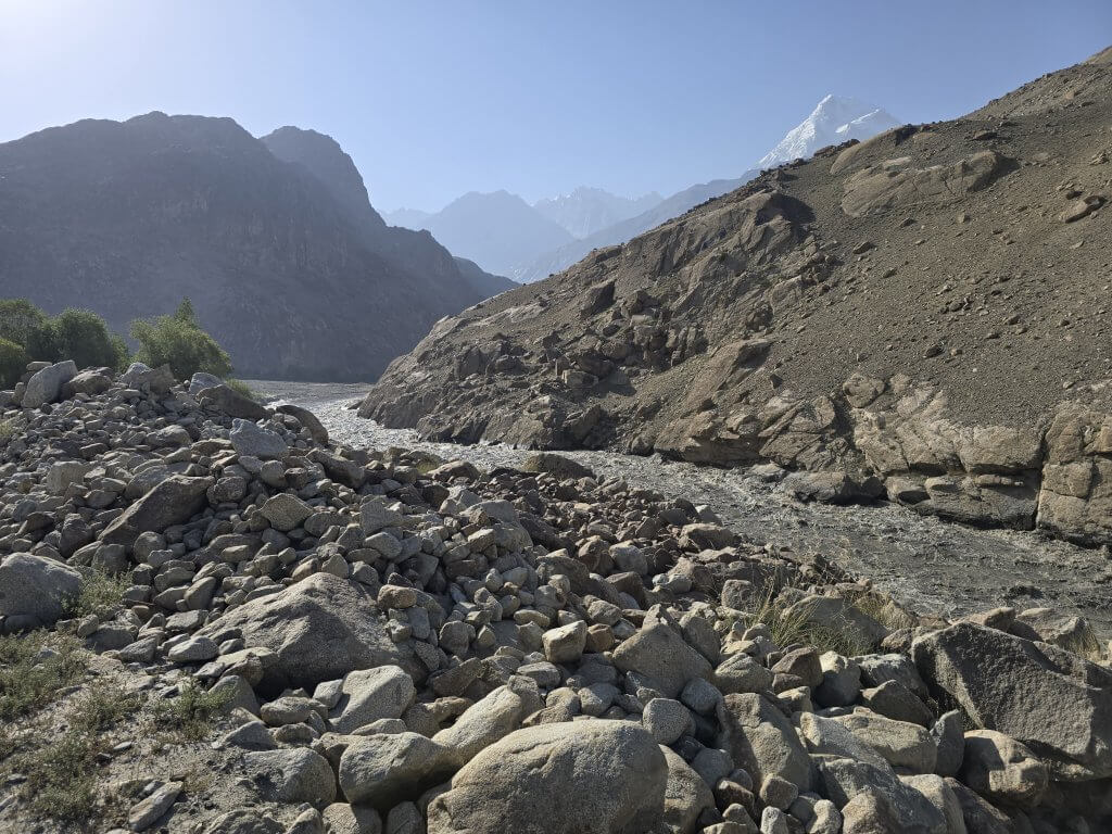
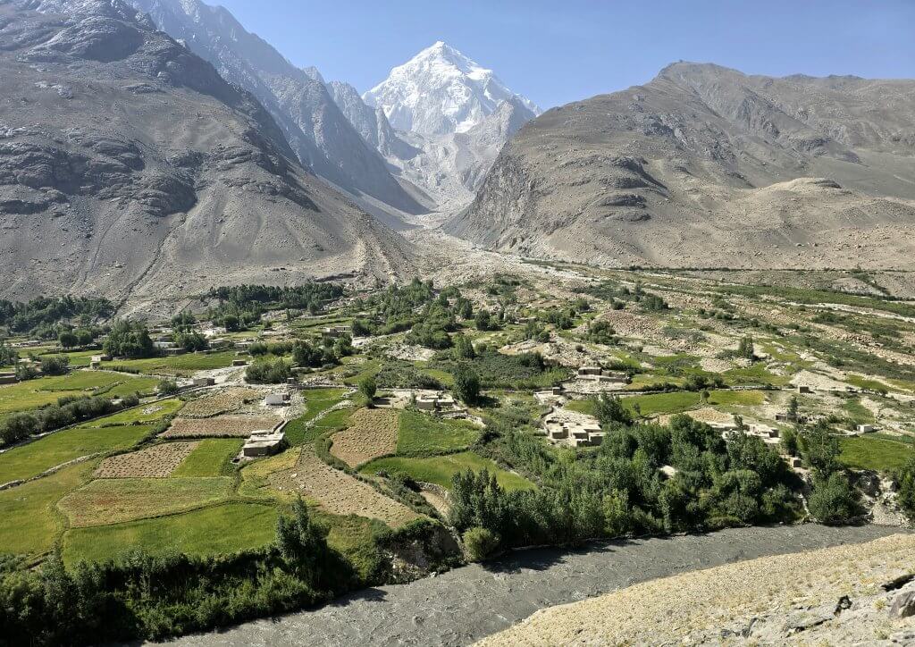
Leaving the team shopping for gifts in the bazaar, I set off alone from Marco Polo Guesthouse, along the puddled dirt road for about four kilometres and out of Ishkashim. At this point I descended into the spectacular Panj River valley. Only a couple of kilometres away, on the northern side of the river, was the Tajikistan town of Ishkashim. I had stayed there during my journey along Tajikistan’s Wakhan Valley a few weeks earlier, so I found it interesting to view the same valley from the south side of the river; a different standard of roads, different people and a different perspective. I had originally planned to cross at the border at Ishkashim but the Taliban had closed it when they came to power.
The view as I entered the Panj River valley – Afghanistan on the right, Tajikistan on the left!
The road to Khandud had a bit of everything, except asphalt. There were many irrigation channels, pools and streams to cross. Most of the time I could ride through the pools and across the channels although occasionally, when I could not judge the depth of the water, I had to carry my bike across. There were sandy, dusty patches where heavy vehicles had gouged deep tracks. Most of the time, the surface was very stony and the loose stones played havoc under my wheels, especially on the short, steep climbs.
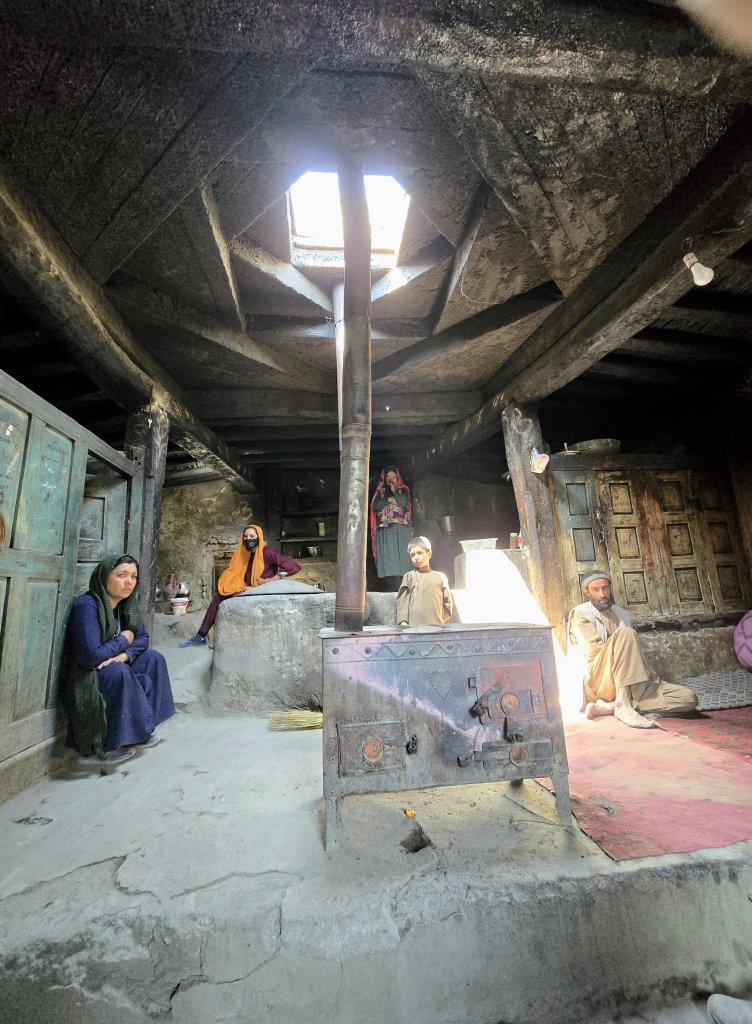
After 21km we arrived at Malang’s village and were invited into his home to meet his family while he collected some gear for the journey ahead.
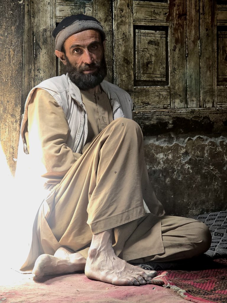
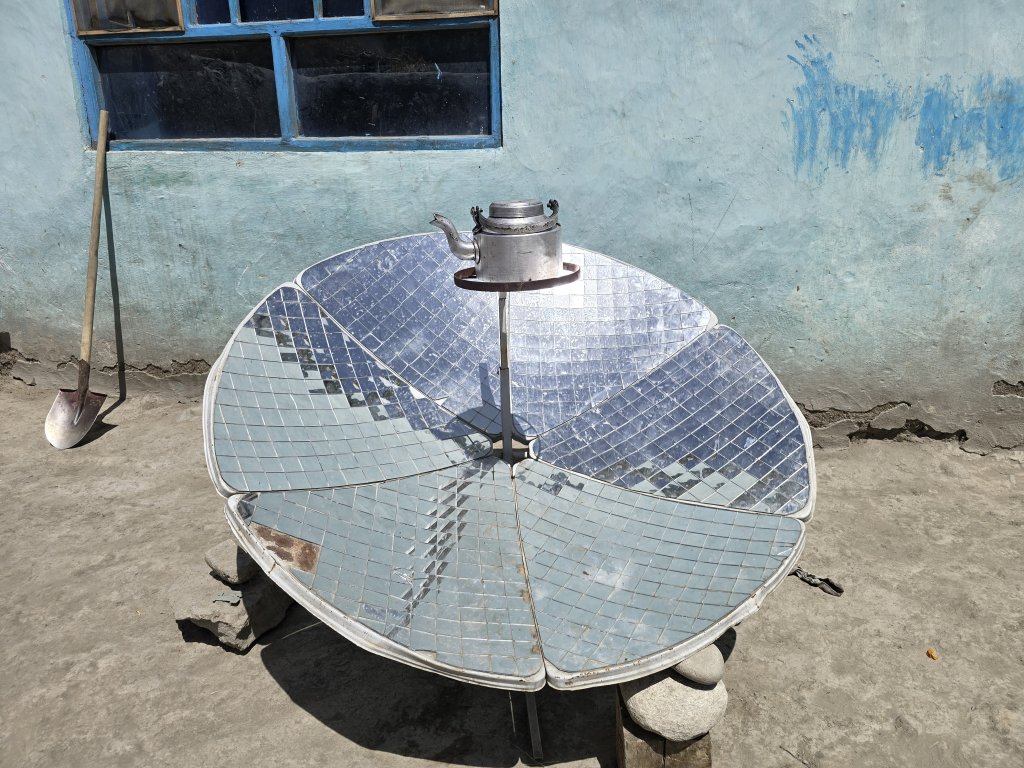
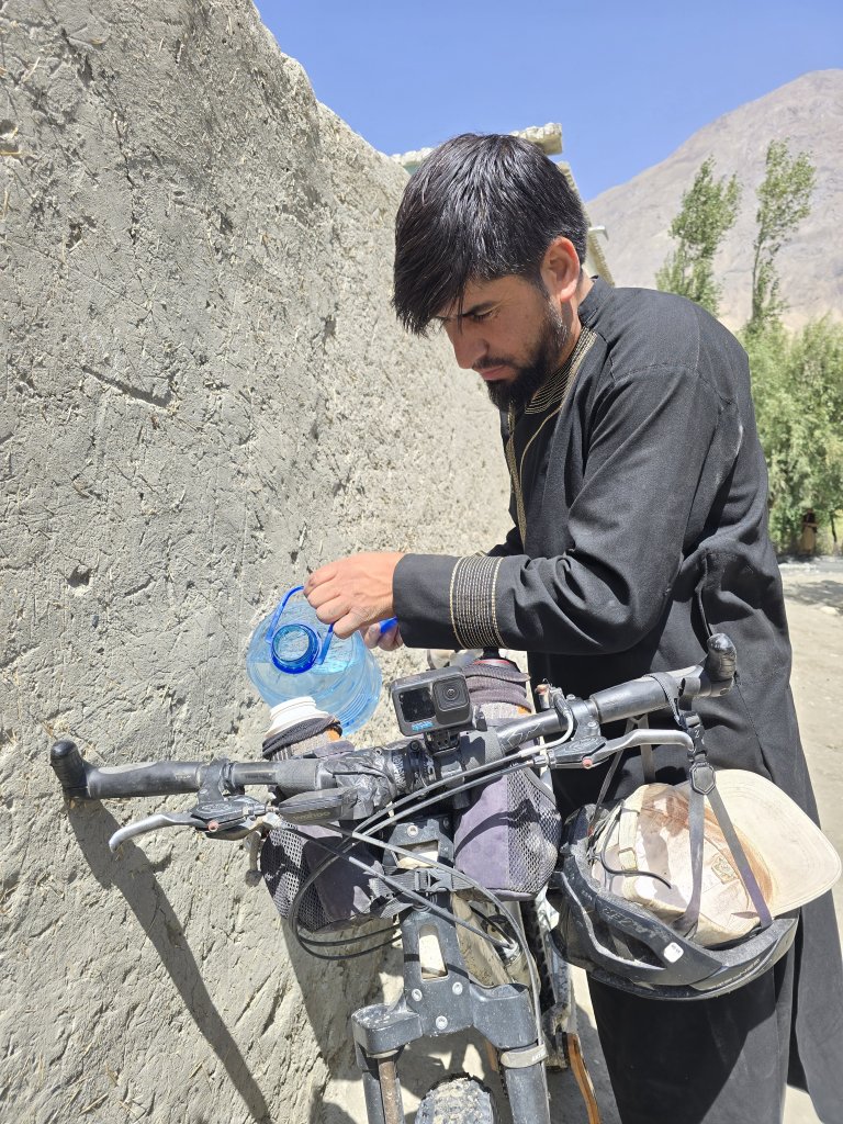
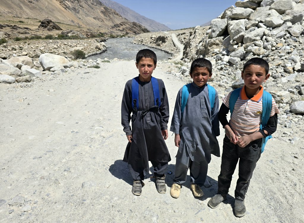
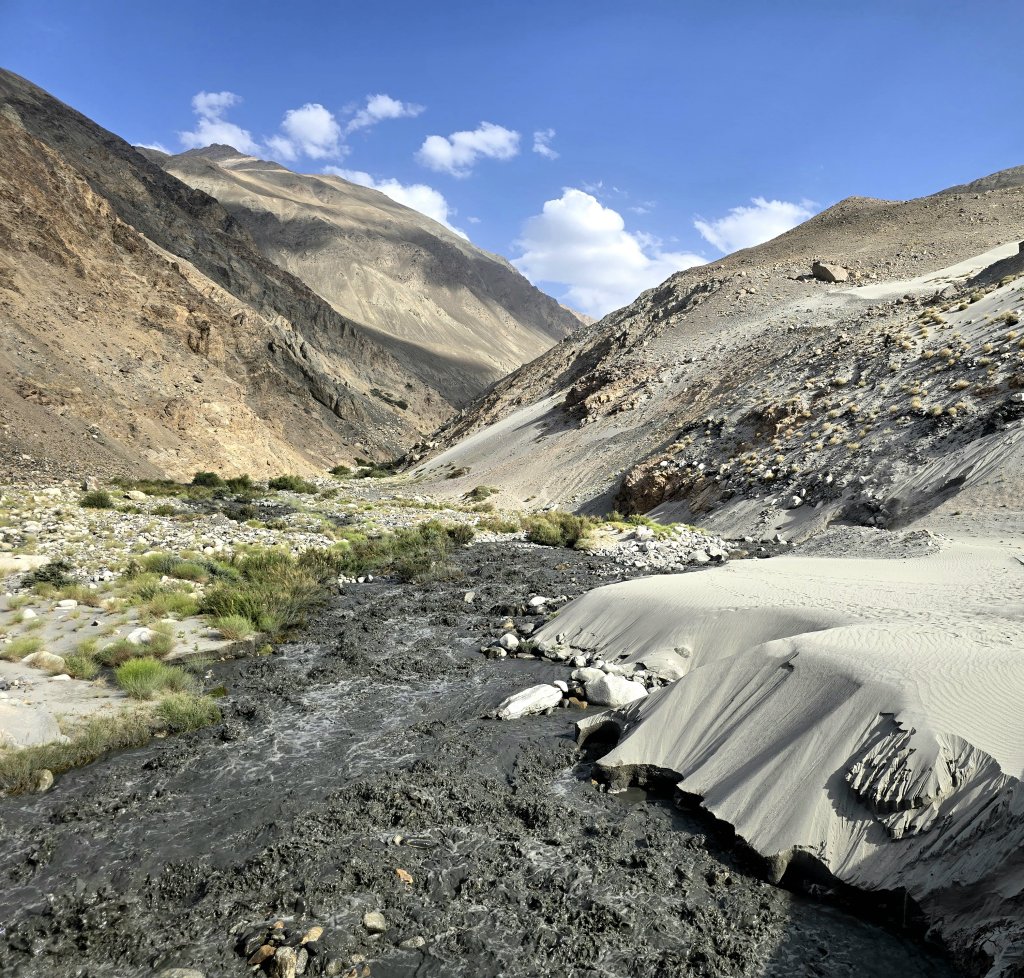
The design of Malang’s traditional Wakhi home has the stove and bread oven positioned centrally with a chimney vent that also lets in light in the summer months. This central heating design efficiently keeps the house warm in the bitterly cold winter.One of the uncles at Malang’s placeAn ingenious way to boil water; the mirrors concentrate energy from the sun on to the kettle, boiling water efficiently with no fuel cost and no pollution.Our driver, Abdiraman became the most efficient assistant I’ve ever had, filling my water bottles the moment I stopped, holding my bike, carrying my bags…whatever was needed. I never expected any of this but it felt as though he would have been offended if I didn’t accept his help. He didn’t speak a word of English but nothing was too much trouble for him once he had worked out what to do.I was often amazed at the strength and endurance of the local children – they work hard are really tough. These three boys ran with me for more than a kilometre as I struggled up the steep, stony pinches.A stream of black water cascading towards the Panj River. I could hear large boulders being tossed around like marbles, such is the power of the water.Black streams are formed by the melting of older glaciers. The older the glacier, the more silt and sand it contains. The oldest glaciers that lie beneath the snow and ice that accumulates annually could be a thousand years old. Each spring and summer, the seasonal snow and ice melts first, but when that is all gone, like this year because of the hotter than usual temperatures, the deeper, older glacier ice melts. This is worrying because when the old glacier ice is gone, it is gone forever. Here, the sand is blown in from the river floodplain.Towards the end of the day, I rode mostly across the Panj floodplain. I passed several trucks because they would always need to slow down for the sand, water channels and swampy patches whereas I could find a quicker way through.
I had cycled pretty well all day but suddenly, in the later afternoon, I ran out of steam – not enough food and rest I think. Malang decided we should stop at Khandud, one of the larger villages in the region that had a guesthouse.
Men at the bazaar in Khandud
Day 141 | 11th August: Khandud to Kipkut – 58km
I again set off alone from Khandud – Adrian and the driver caught me after 23km but Rupert wanted to make the most of the intermittent internet there and requested that Malang wait with him and find a local car to catch us up. This wasn’t ideal because it prevented Malang from being with the team as our guide. Finding a car suitable for the rugged terrain at short notice in the village was difficult. Due to the terrible road conditions, there just aren’t many cars. They didn’t catch us until the end of the day because the car they hired broke down twice.
Travelling alone I had to keep the Wakhan Corridor permits in my top tube bag to show at the checkpoints. Malang is well known in this area and often when I mentioned his name, the Taliban let me through. There were a lot of villages over the first 10km out of Khandud, meaning almost continuous water crossings. Some faster flowing streams required me to carry the bike. This meant I had to stop to remove my shoes and put them back on again once I had crossed the stream – all very time consuming over the course of the day.
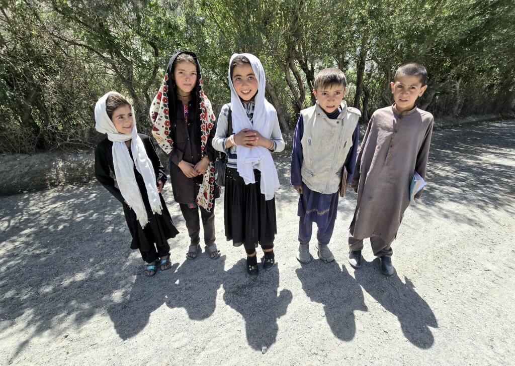
The school children were always polite and interested in me and my bike, but never overpowering as kids in some other countries can be. They mostly learn some English at school. Girls only get to go to primary school here – unfortunately – and women are now being prevented from working.Next came the open floodplains and sand. Here, a part of the road had been washed away by the flooding Panj River and drivers had to struggle through temporary tracks that were deeply rutted. My three inch (7,5 cm) wide tyres were pretty good in these conditions but some of the path was unrideable. I had to push for about 400m.
The problem has occurred because during winter the valley has been receiving extremely strong winds that push the snow up the mountains. The hotter than usual summers are melting the glaciers faster. This all results in more water coming down from the mountains, causing the Panj to flood. It not only erodes the road, but also the grassy plains where the Wakhi graze their animals, reducing the area of fertile grassland they can use. It is a worrying situation for the Wakhi people who depend on the grassy plains for their livelihoods.
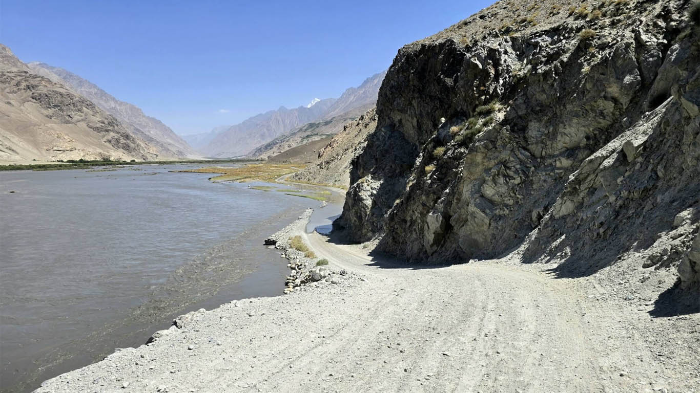
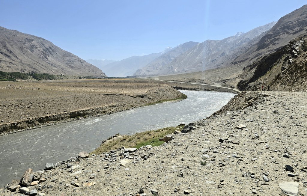
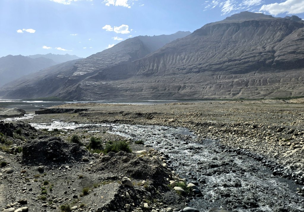
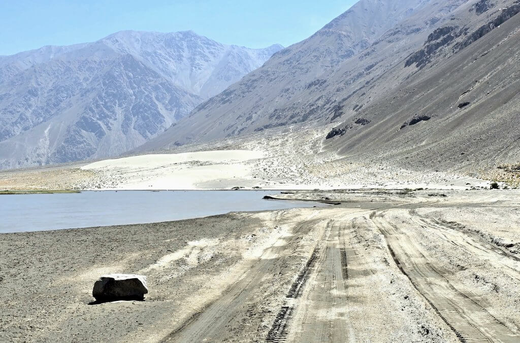
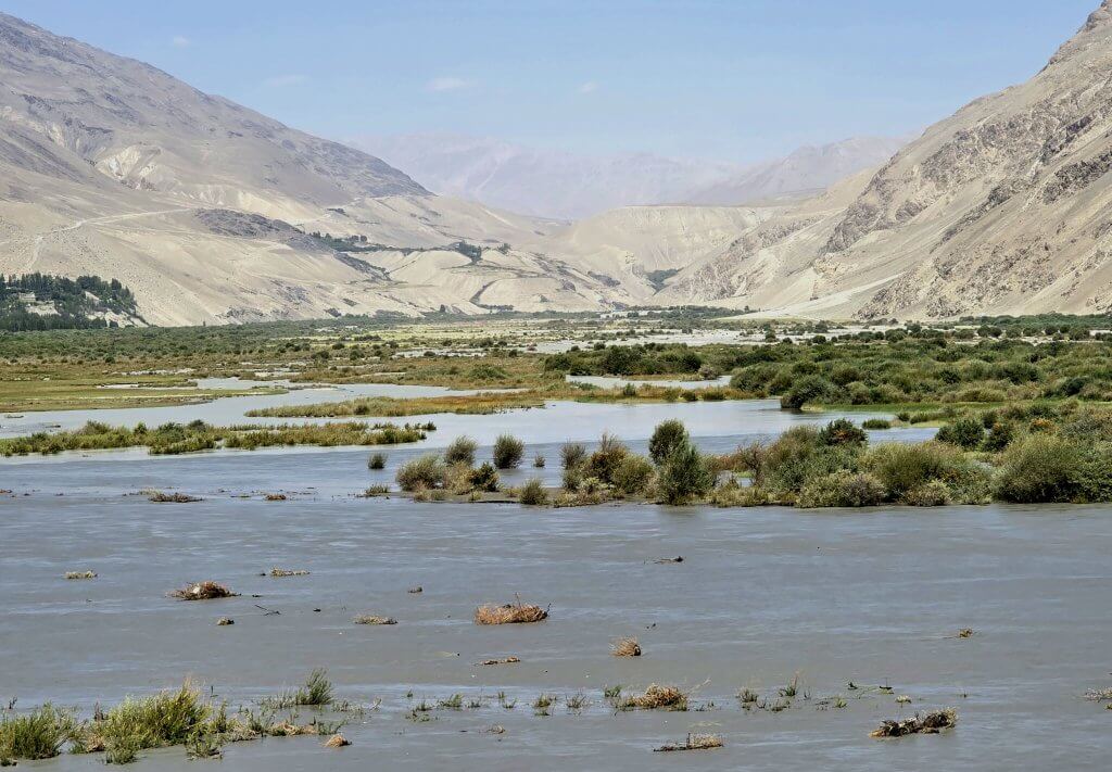
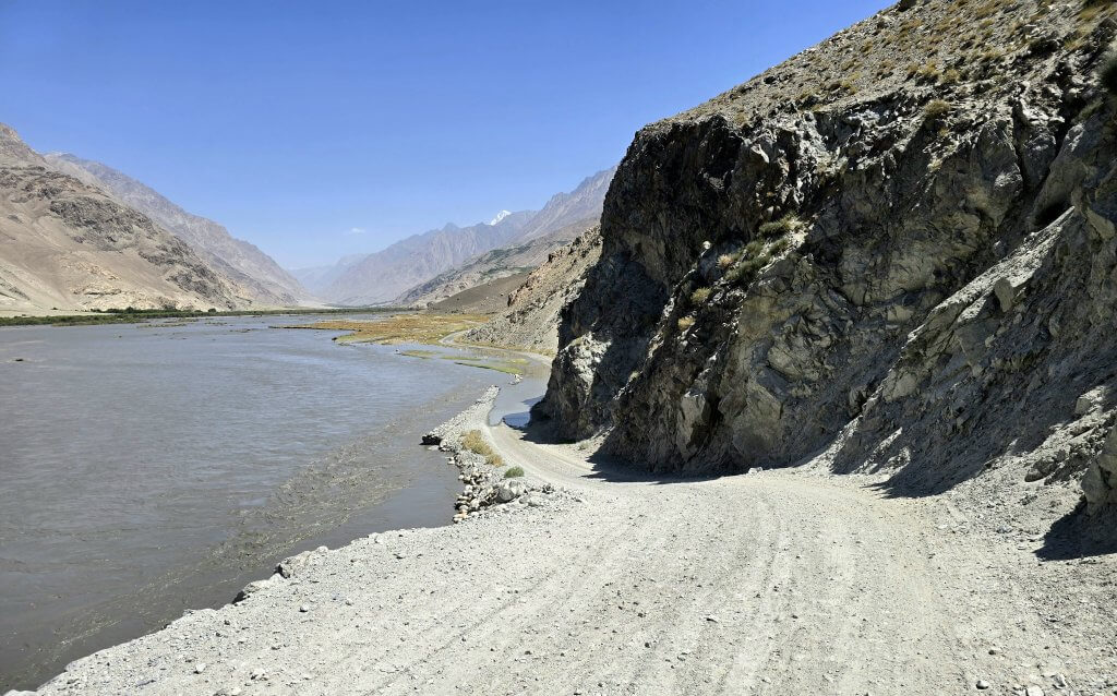
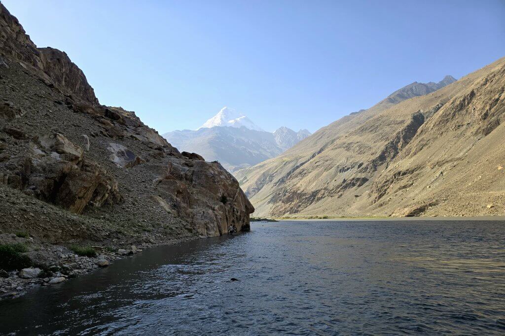
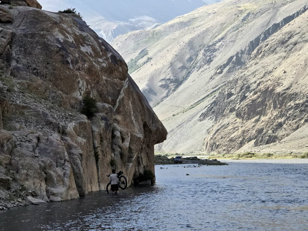
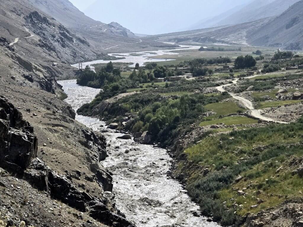
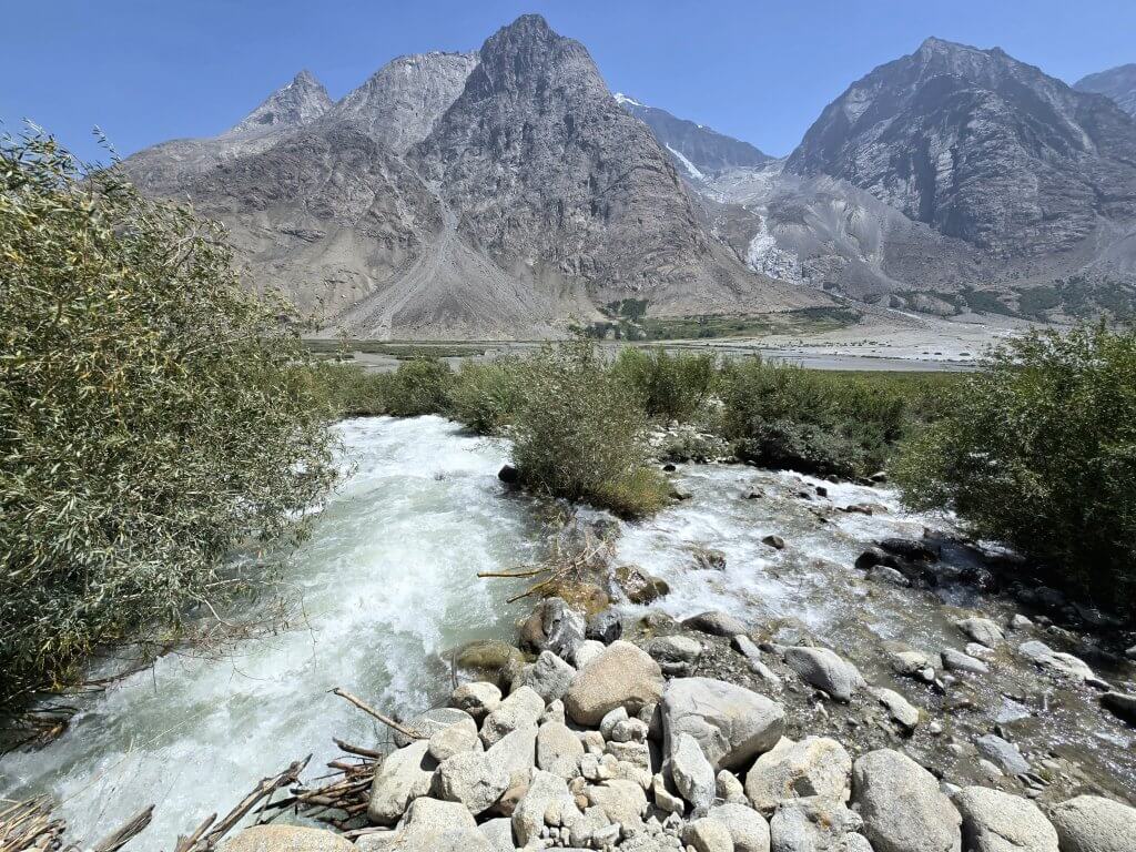
After about 30km I reached the confluence of the Pamir and Wakhan rivers – the start of the Panj River. I had cycled along the entire Pamir River (that flows out of Zorkul Lake) a few weeks earlier but when descending Khargush Gorge to Langar, I didn’t have a great view of the confluence. This image shows the road I descended into Langar and the end of the Pamir River. The faster water in the foreground is from the Wakhan River that I followed from this point.The Wakhan River was also extremely high and parts of the road were flooded. This was the first inundated section that required me to carry my bike and wade through deeper water. I had to go barefoot for this crossing because the vehicle had gone through first, taking my sandals by mistake. Unable to see where I am treading in the murky water, I moved very cautiously so not to cut my feet or trip on the larger stones.It was generally much tougher cycling beside the Wakhan River because it was a steep-sided narrower valley. The road was a rollercoaster of sharp ascents and descents, and extremely rough due to the stones and water falling/flowing down the slopes.After 47km I arrived at what is probably the only roadside restaurant in the Wakhan Corridor. I noticed a broken high-tech bicycle on the roof of a vehicle and three more bikes leaned up against the restaurant. Myself and the German/Belgium cyclists were very surprised to see each other. They were just returning from a ride to the Little Pamir. One bike was broken and the cyclist was travelling in the car. We had both heard of a cyclist riding in the region earlier in the season, but that was it – no one else had cycled in the Wakhan Corridor this year, and cycling here is extremely rare, for good reason. Eggs and chips were on the lunch menu, which went down very well with the standard tea (chai).The next 11 kilometres was an intense session of terribly stony climbs and water crossings. Black water was roaring down the Wakhan River. When I reached Kipkut, near Sargez village, I was fully expecting to ride for another two hours. That would have got me within 25km of Sarhad and allowed me to have almost a whole rest day. However, in Kipkut I was advised to stop because in the late afternoon the water levels are higher due to the daily melting of the glaciers and there were a couple of deeper water crossings ahead. Malang and Rupert had not yet caught the team due to two breakdowns and the vehicle they were travelling in was ill-equipped to cross the deeper water. The guesthouse was in an idyllic location and had extremely friendly hosts but they weren’t very prepared and would need to make some adaptions if they are looking for regular guests. Rupert and Adrian both fell ill, probably from the chicken that I thankfully avoided because it looked suspect.
Day 142 | 12th August: Kipkut to Sarhad e Broghil – 53km
Two kilometres out of Sargez I faced the biggest water trap. The road was completely submerged, requiring me to carry my bike for about 250m. At the deepest point, water came up to my mid-upper thigh. I had to predict where the road was beneath the murky water and stick to the line of it as this is where the water was shallowest and I was less likely to hit big stones. My shoulder was sore and bruised from balancing the bike on it by the time I reached the other side.
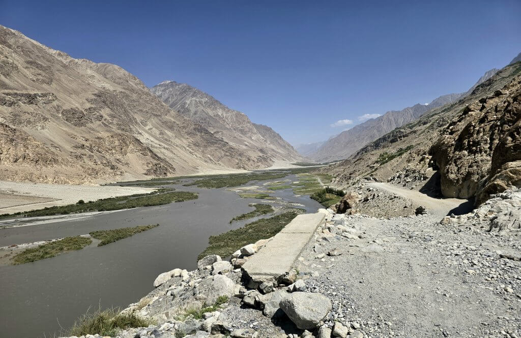
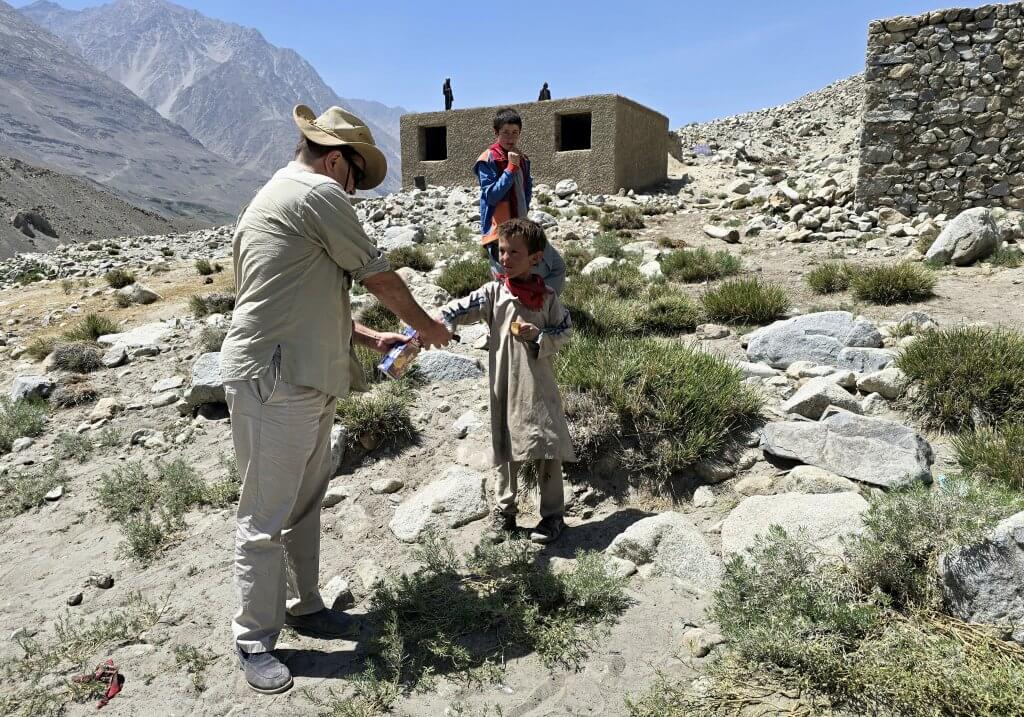
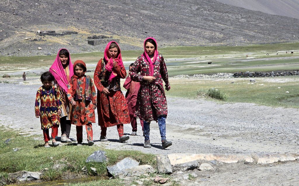
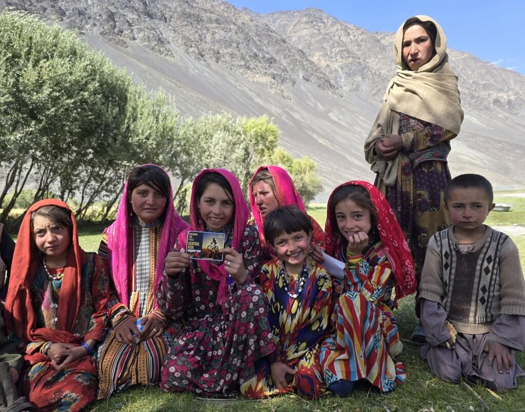
It’s not easy to spot me in this image. Around the corner the road was flooded for at least another 100m.There were many more significant water crossings on this final section into Sarhad and I regularly found myself cycling through water on the inundated road. Another flooded part required me to carry the bike for four long sections. At the same spot, the team rescued a vehicle that was bogged in the quagmire.Almost immediately after I traversed the first flooded section of the day, the serious climbing began. The gradients of several steep sections reached 15+ percent. The road I followed is on the left hand side of this valley where there was often little room for a road at all. The road here climbs high above the river, then drops sharply to a flatter bend in the river, then rises steeply around the hill in the distance. This was typical of the road I faced. The difficult gradients lasted for about 15km after which there was some relief, but it was still dreadfully rough.A village below the incredible Baba Tangi mountain (6513m)Rupert giving small gifts to Wakhi children.Everywhere I looked, every corner I turned, there would be a picture postcard view to ease the pain of my lactic acid-filled legs. At altitude the body needs longer to recuperate due to there being less oxygen in the air, but I could not afford any more time to rest if I was to reach my destination.With about 15km to go to reach Sarhad, the valley opened out into a huge pamir (high grassy plain), perfect for the local Wakhi villagers to graze their animals.Wakhi girls and women always dress beautifully in bright colours, mostly shades of red. In Wakhi culture, women have a much more equal standing than in other cultures in Afghanistan. Women work, interact socially and pray equally with men.After Malang acquired some flat bread (nan) from a village, lunch included the unleavened bread, cucumber and cream cheese (that keeps for a long time in its packaging). We soon had a large audience of young women and children. Some were particularly hungry so we shared our bread and cream cheese. I gave out some of my expedition postcards and Rupert provided some pencils that were really appreciated.
Sarhad e Broghil had always been the end of the road until 2023. Prior to 2023, the only way to travel further east, into the Little Pamir and Lake Chakmaktin, was on foot often accompanied by donkeys to carry the load. Two years ago a gravel road was built giving easier access to the region, especially for a cyclist. I was going to include the story of my ride along the road in this blog, but that would make this entry too long – it deserves a seperate post…
PLEASE TAKE ACTION
THIS IS THE LAST MONTH OF MY CAMPAIGN FOR WATER.ORG. WE HOPE MORE PEOPLE WILL CONTRIBUTE AND GIVE WATER.ORG A BIG BOOST!
Support my Water.org fundraiser to help bring safe drinking water and sanitation to the world: Just $5 (USD) provides someone with safe drinking water or access to sanitation, and every $5 donated to my fundraiser will enter the donor into the Breaking the Cycle Prize Draw.
FOLLOW THE JOURNEY
Thanks to ZeroeSixZero, you can open this link on your phone and select “add to home screen” and the map will become and app. You can then keep updated in real time.
TAKE ACTION
Support my Water.org fundraiser to help bring safe drinking water and sanitation to the world: Just $5 (USD) provides someone with safe drinking water or access to sanitation, and every $5 donated to my fundraiser will enter the donor into the Breaking the Cycle Prize Draw.
EDUCATION
An education programme in partnership with Exploring by the Seat of Your Pants, with contributions from The Royal Geographical Society and The Duke of Edinburgh’s International Award Australia. We have created a Story Map resource to anchor the programme where presentations and updates will be added as we go.
Share your love
Kate Leeming
Explorer/adventurer. Kate has cycled a distance greater than twice around the world at the Equator. In the early ’90s when she rode a total of 15,000 km as her way of experiencing Europe, Kate developed her passion for travelling by bicycle. Since then, Kate has stepped it up, performing three major expeditions: the Trans-Siberian Cycle Expedition from St. Petersburg to Vladivostok, the Great Australian Cycle Expedition with Greg Yeoman and the Breaking the Cycle in Africa expedition from Senegal to Somalia. Her next venture is Breaking the Cycle South Pole, which will be the first bicycle crossing of the Antarctic continent via the South Pole. She is preparing for this challenge with expeditions (polar, sand, altitude) on six continents.