29th June – 4th July | Rushan to Murghab | Distance: 529km | Total Distance: 6541km
Following the Amu Darya from the Aral Sea to it’s source(s) is a complicated journey. So far I have followed the Amu Darya, its key tributary, the Zerafshan River, then back to the Amu Darya to where it turned into the Panj River (at the confluence of the Vakhsh River). But from Rushan I am starting to explore the key tributaries that lead to its sources – one being the Amu Darya’s true source.
Day 98 Rushan to Basid 84km
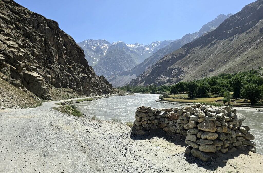
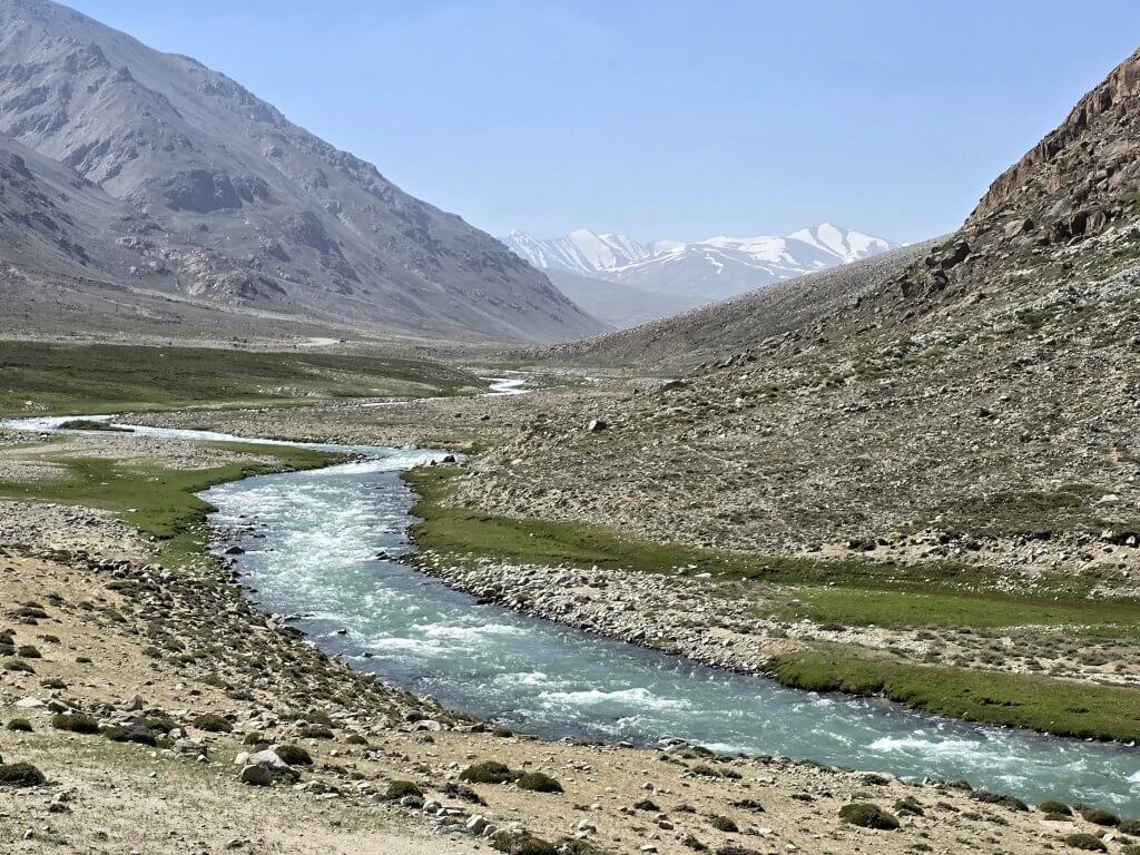
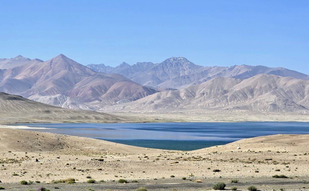
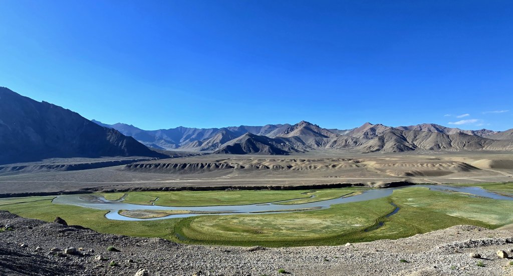
Rushan is where the Bartang River flows into the Panj. The Bartang River becomes the Murghab and then the Aksu rivers. The Aksu flows out of Chaqmaqtin Lake in the Wakhan Corridor, Afghanistan – one of the recognised sources of the Amu Darya.
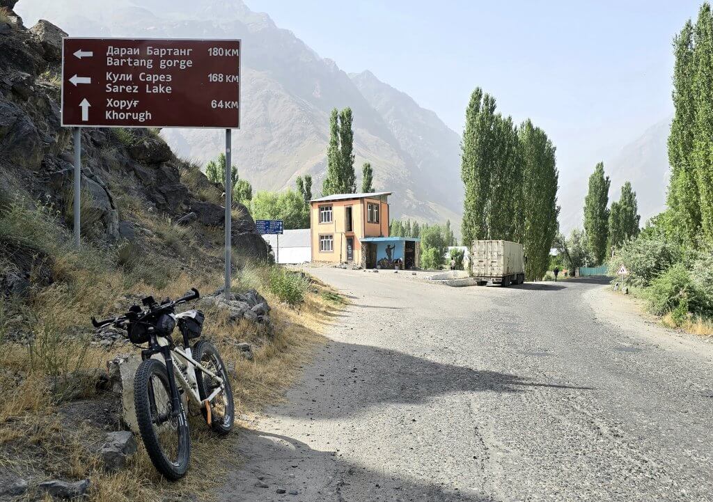
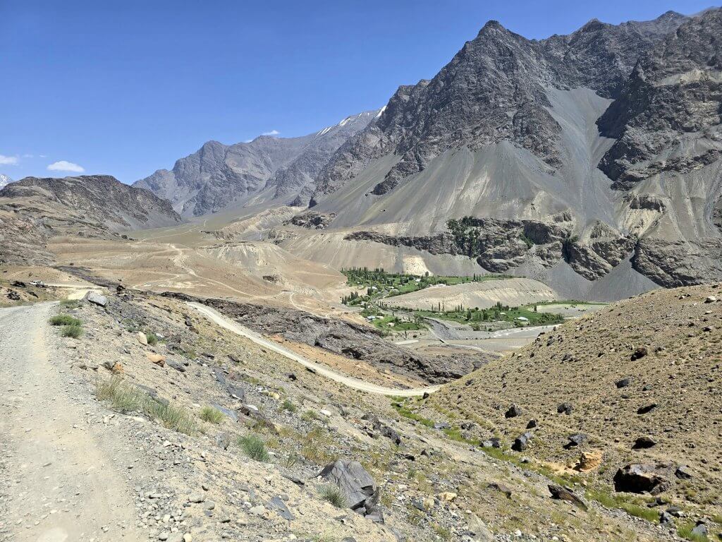
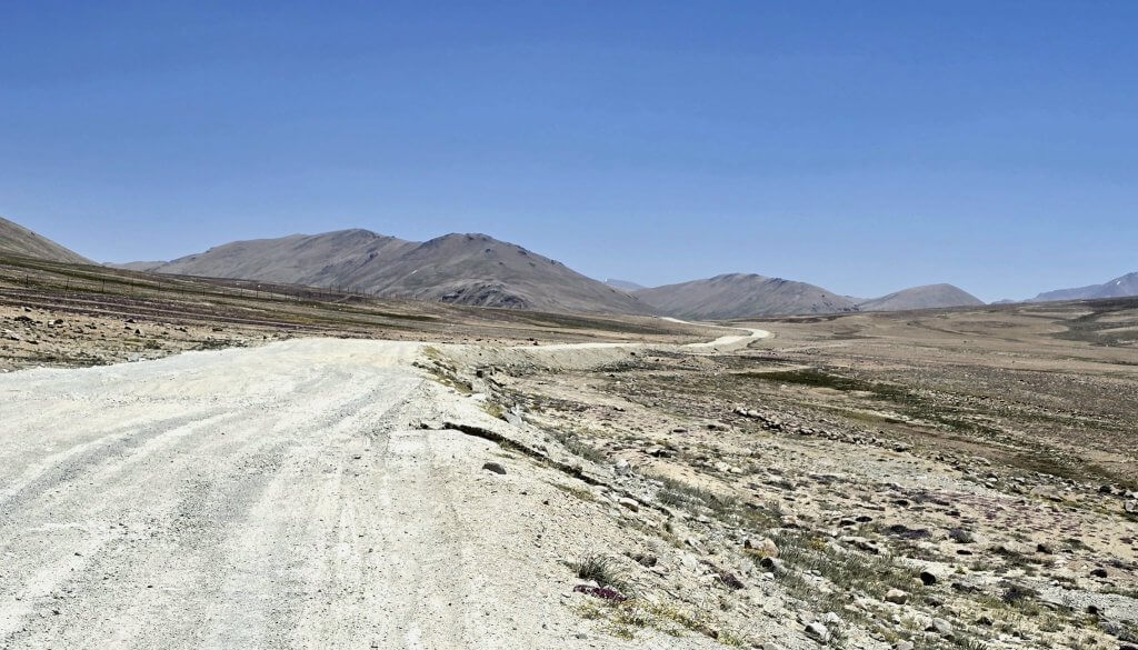
Five kilometres out of Rushan I turned onto the Bartang Valley Road. We had heard that the river is extremely high at the moment due to the extreme heat wave melting the glaciers faster than usual, so there was a chance the track would be blocked in the narrow valley. Getting a vehicle through where the track could be washed away or flooded is particularly dangerous and so Alisho, who has been coordinating my journey through Tajikistan, took a taxi from Dushanbe to join the team and help out.
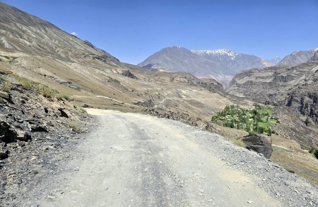
The Bartang Valley turnoff from the main road
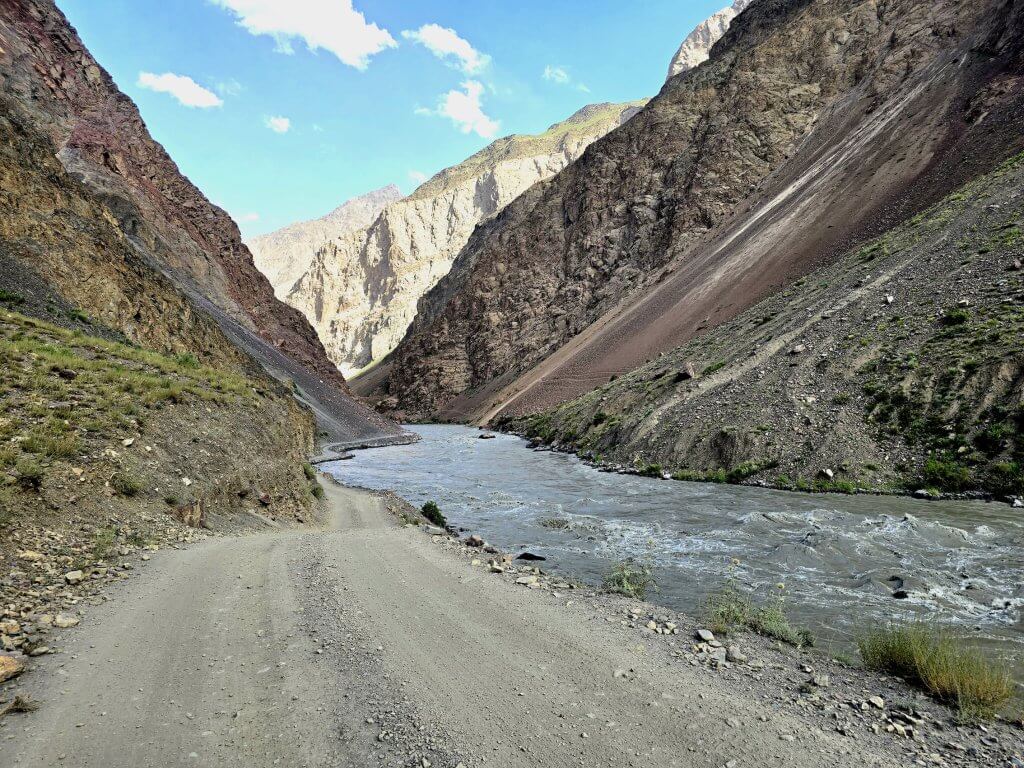
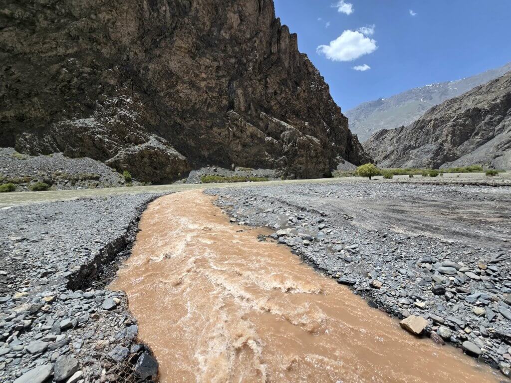
Over the first 20km, there were small patches of Soviet-made asphalt that quickly crumbled away into loose gravel, big stones and wash aways. The road closely conformed to the river, which was indeed flowing fast and the waters lapping at the edge on the road at times.
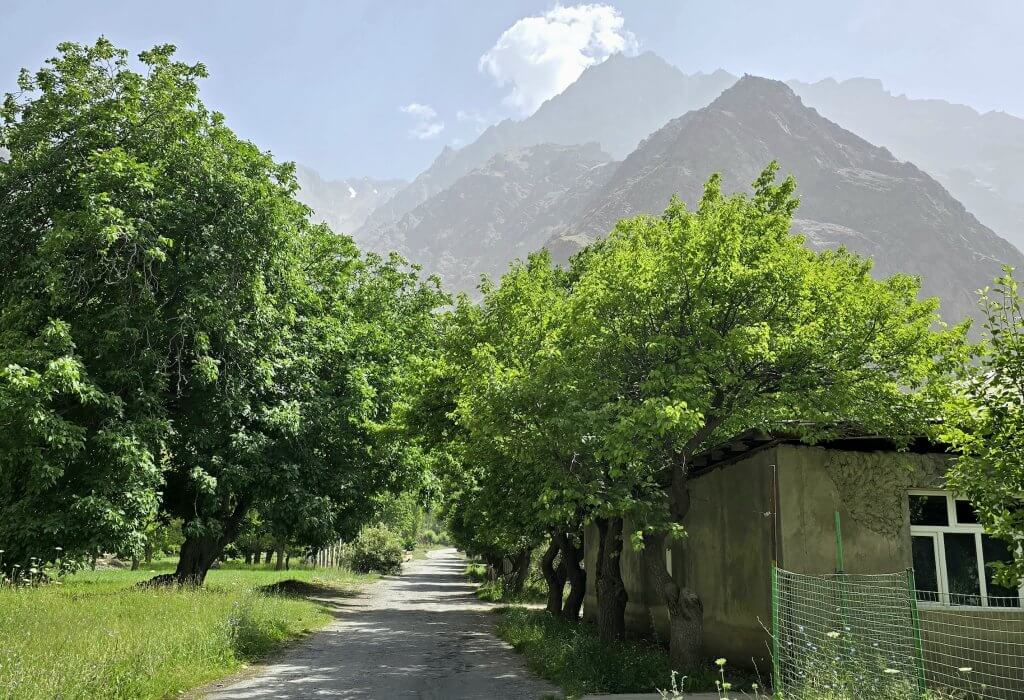
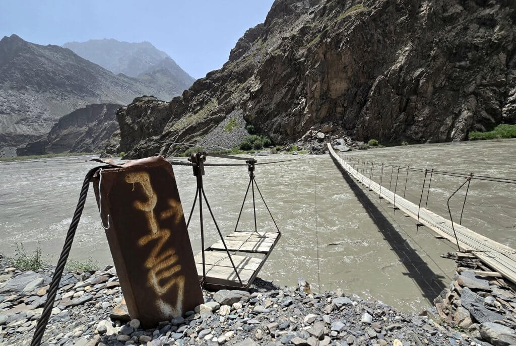
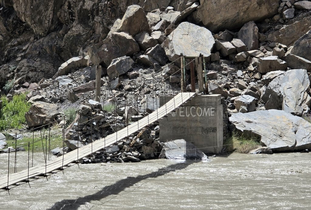
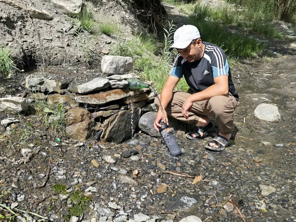
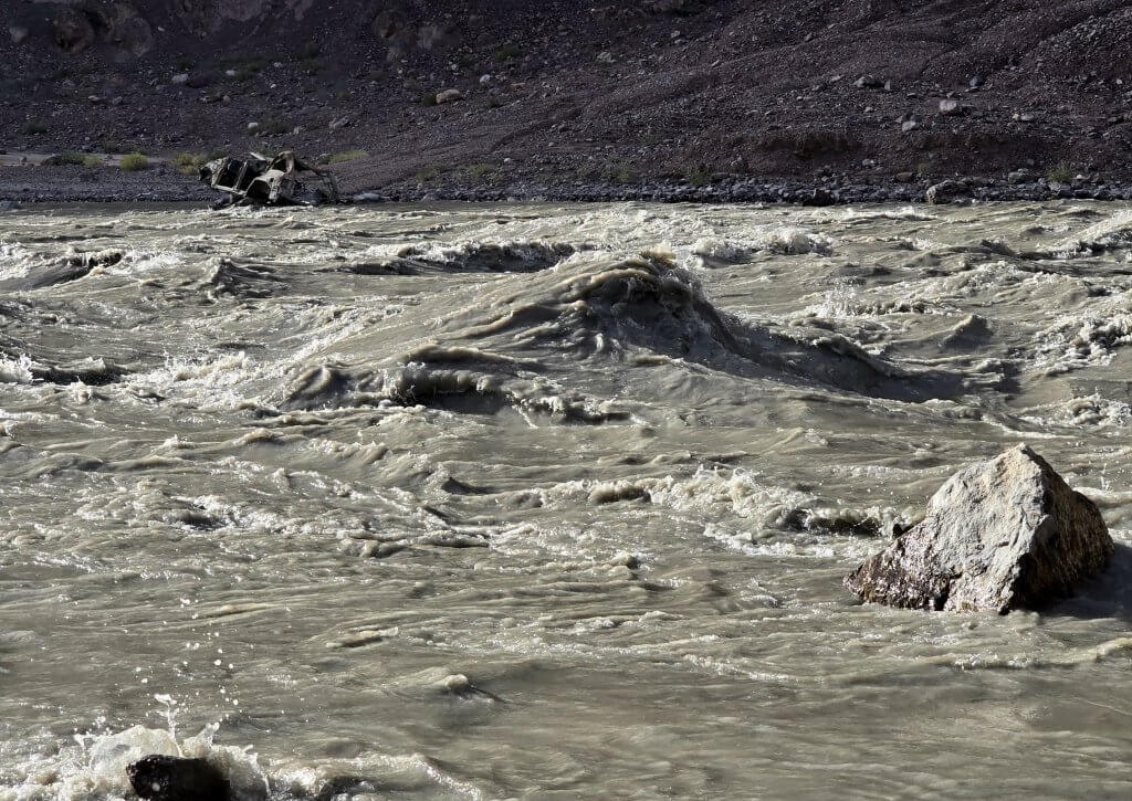
Villages were dotted along the valley, usually a comfortable distance from the water, on higher ground. Villagers must be pretty self-contained because they can easily be cut off, in summer, spring and winter! In winter they are snowed in, in spring it is the snow melt and in summer, the glaciers. Always villages are vibrant green (in summer I expect)After 25km, we came to the footbridge to Jizev village. This is the only way villagers, and now travellers, can reach the village, a 7km hike away. In the photographs I’ve seen of the bridge, the water was much lower.Welcoming tourists to their home-staysStreams from fast-melting glaciers cascade into the Bartang near Dasht villageAlisho filling my water bottle with pure spring water. An ingenious use of a beer bottle!Around every corner there was another stunning scene. There was only just room for the track between the cliffs and the river. I was quite worried the water would soon block the route and we could be trapped with no way out. Still, it was exhilarating to cycle so close to the raging torrentThe river was wild in many places. Note the washed up car on the far bank
Day 99 Basid to the end of ride track up the Bartang – 68km
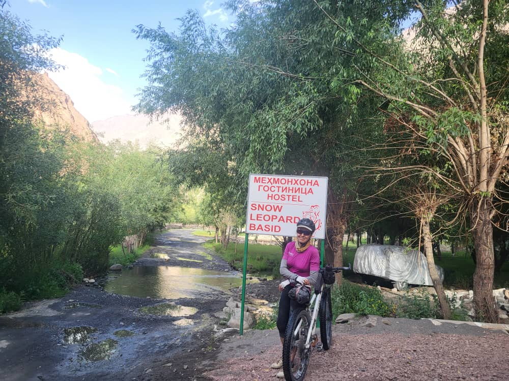
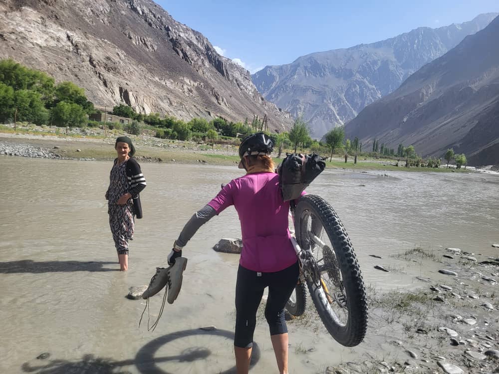
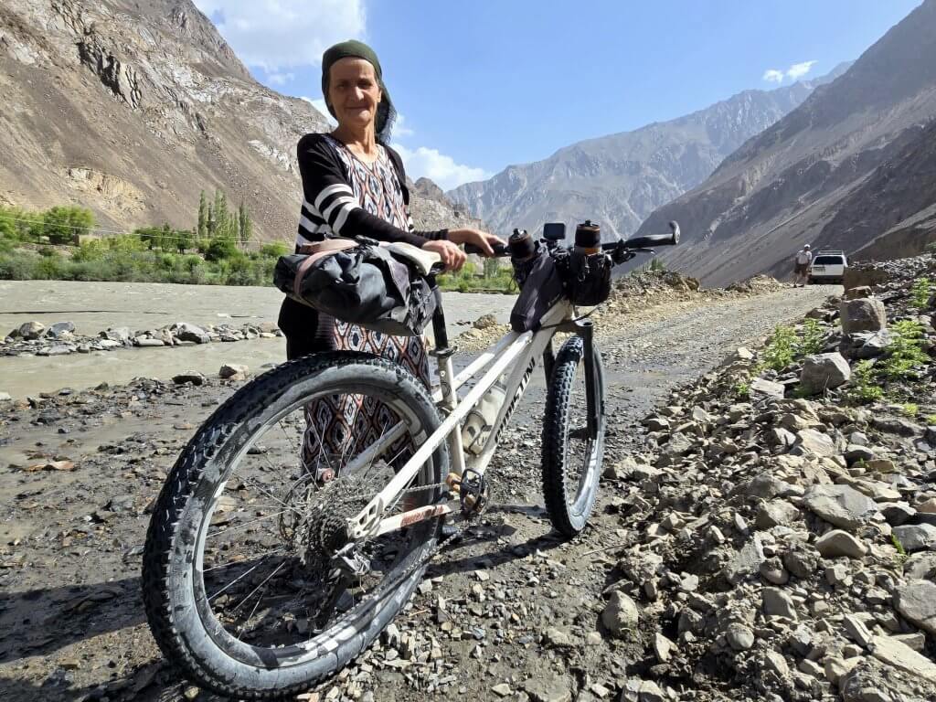
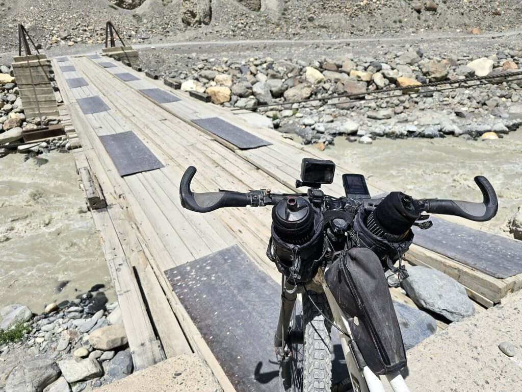
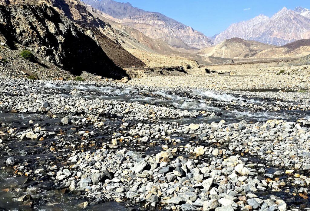
Karim and Alisho found a great hostel in Basid village. I was very happy to rest up for the night after cycling 84km on extremely rough terrain with continuous steep climbs and the rough stony road. The track was often a string of puddles where water flows down the cliffs. The owner of the hostel said his family had lived in Basid for 700 years! (image by Alisho)Five kilometres into Day 2 on the Bartang and the water seemed higher. This was the first water crossing. The women helping me sight the route across was the shop owner from the village across on the opposite bank. She was waiting on the other side to help those wanting to cross. (image by Alisho)About 200m further along, we had to cross the flowing channel back to the other side near a stony ford. The woman was there to help, carrying my shoes as Alisho accompanied me across the second time. I cut my toe on the sharp stones, but nothing serious. Here she is waiting for me to put my shoes back on
Day 2 seemed to be harder going – and Day 1 was already exhausting! I was feeling particularly low on energy because I was again struggling with diarrhoea. There were so many steep climbs of 10%-15% gradient on loose gravel. These really sapped my energy. Progress was slower because water crossings take time and we took an early lunch after just 35 km covered.
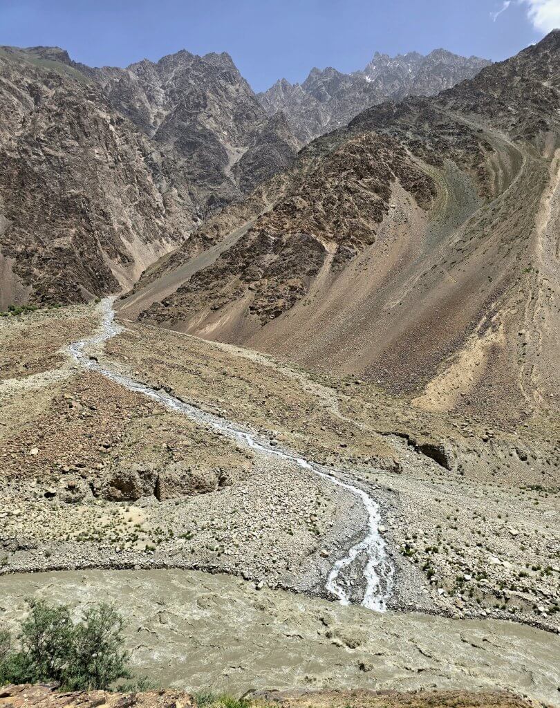
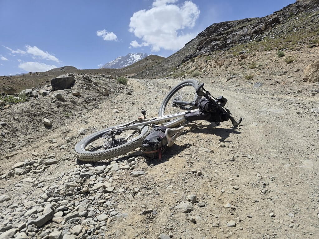
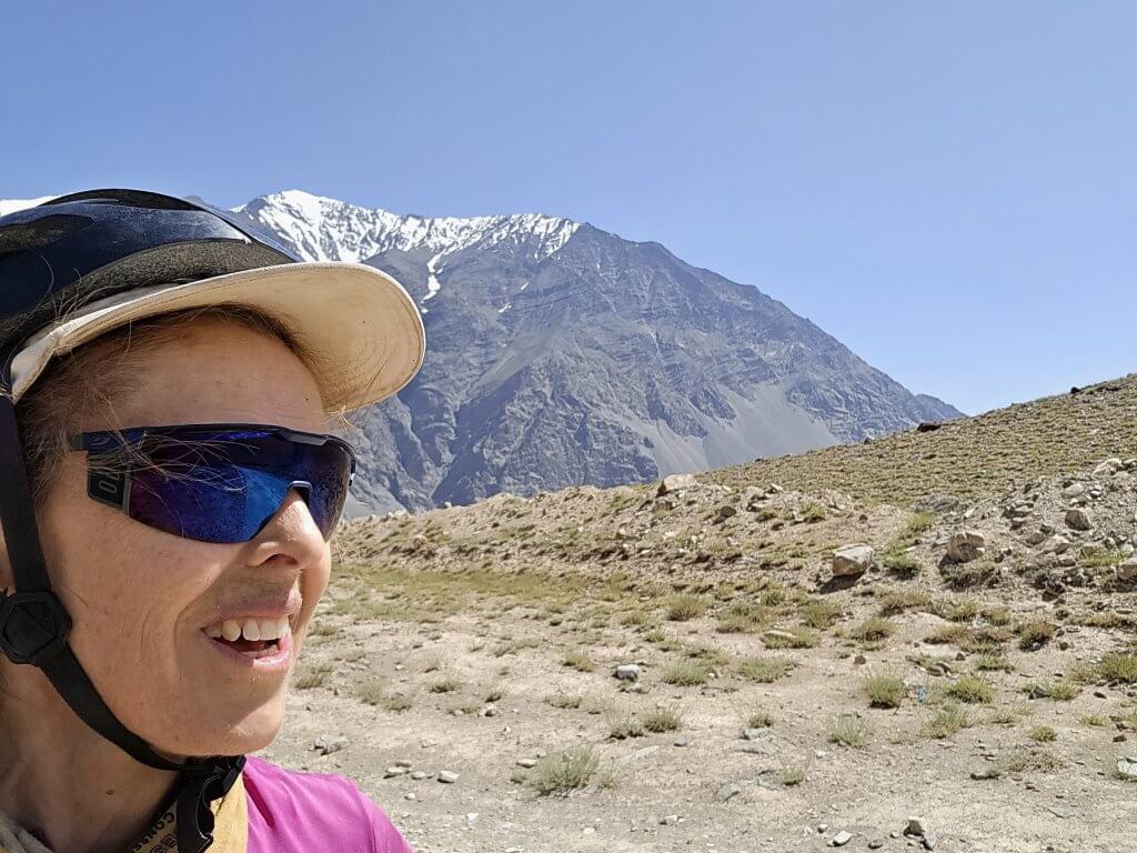
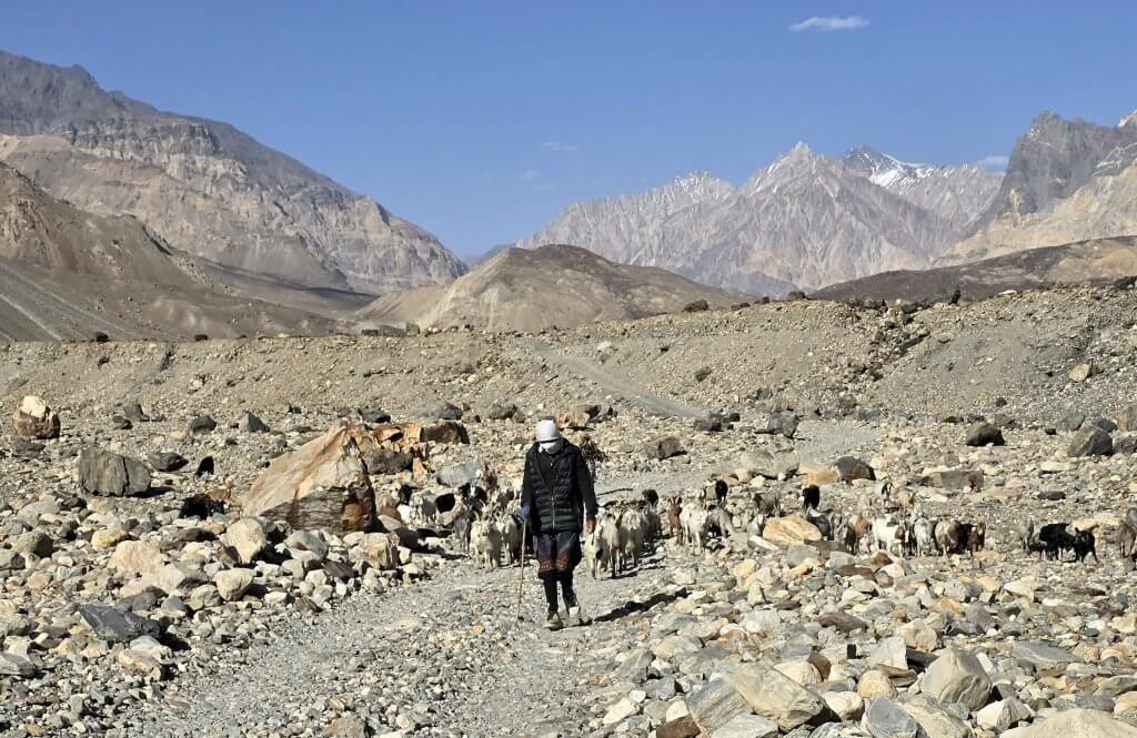
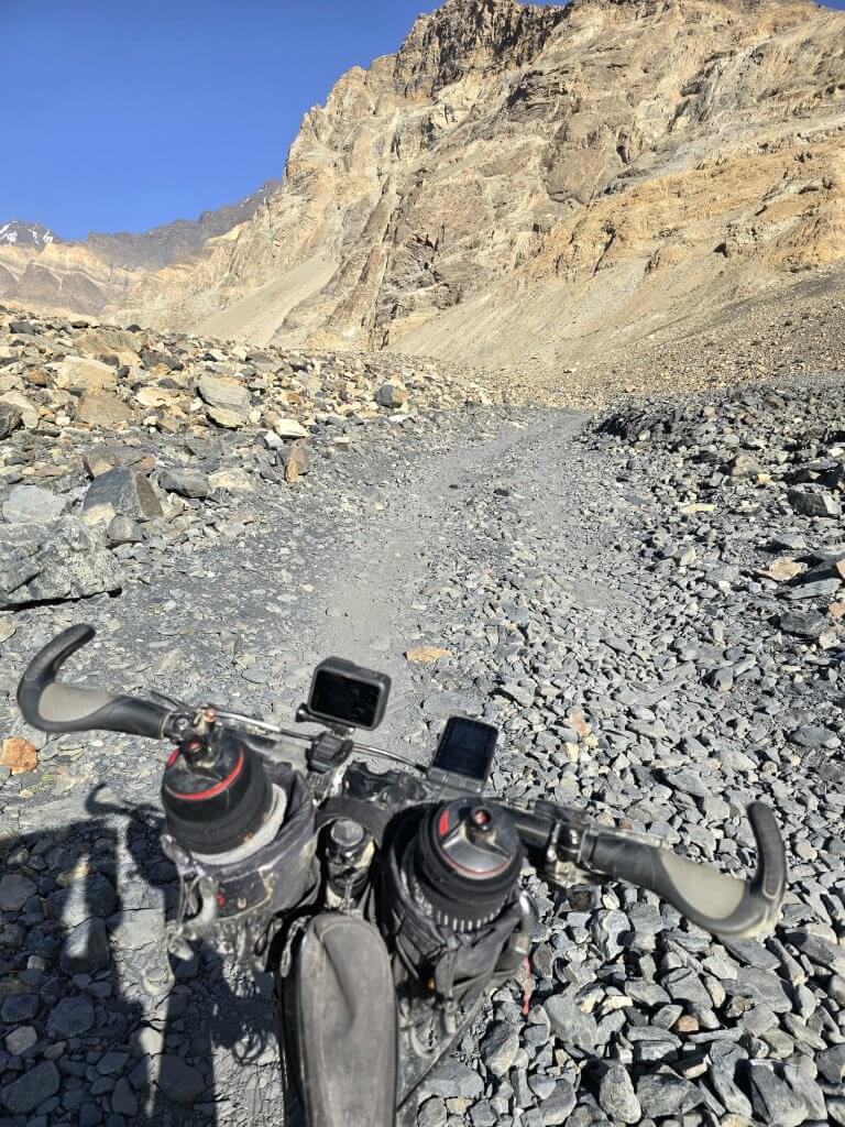
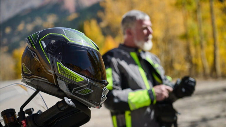
In some of the streams, the water flowed like blood from the red mountains. The Bartang and its tributaries are full of silt when the glaciers are melting. Earlier in spring however, when the snow is melting, the water would be aqua-blue and crystal clearThe route was continuously spectacular. Quite often I would be gaining 20-50 metres in altitude and then have to take it very cautiously on the steep and gravelly descentsI think these were flowering tamarisk trees (or similar), many inundated by the flooding river. Incredible colours!Some of the streams flowing into the Bartang were also formidable and the track diverted up the side valleys several times before a bridge could be constructed for vehicles (and bicycles)One of these steep climbs kept going, up and up! It is one of the most difficult climbs I have ever done – incredibly steep, very rough with big stones embedded into the track and plenty of loose gravel. I always try to not stop on a climb, at least the steeper parts because it is very difficult to get started again. Half way up this climb, the track levelled out briefly (to maybe a 5% gradient) and I stopped to capture this sceneI continued the grind using my bottom two gears, trying to relax as much as possible to keep my heart rate in check. About three quarters of the way up, I was tackling a very steep hairpin, hit a large stone and slipped on the loose gravel stones. At the same time as hitting what was about a 25% section, a gust of wind caused me to overbalance and I came crashing down the slope. My head was saved by my helmet and I finished with my head pointing down the slope. I lay there for maybe 30 seconds and gathered myself. I was shaken but OK. I walked the next 100m or so until I was ready and there was a lesser gradient to restart the struggle. This is how the bike ended up after the fallI finally made it to the 2927m summit after gaining about 500m. I took the obligatory selfie, but not sure here whether I was still gasping for air or at the awe-inspiring view!Before me was a vast plain eventually dropping back to the river. This scene is looking back to the summitThe fall had really dashed my confidence and I still felt shaky, even after meeting up with the team and trying to compose myself half way down. I felt very nervous descending, gripping my brakes tightly, and my body rigid as I tried not to think about slipping over the edge. I was very tired but had to continue. We needed to get to the village where the water may be blocking our path to make a decision whether to continue. After that there would be no villages for 150km to Karakul LakeThere were several uphill sections where water streamed down the road and I had to ride over the stones and against the tide (so to speak). One of those sections led to this stream powering over the stones. It was another tricky water crossing. The water is ice-cold, straight off a glacierFrom the water crossing, there was a steady uphill, incredibly stony. I was totally spent, had nothing left in the tank. After passing these women driving their goats, things got worseI didn’t have the strength and ended up pushing over these surfaces. The team was waiting half way up another incredibly steep pass. We were about 12km from the village and it was obvious we were going to run out of daylight. Several people had already told the team that no one could get through after the infamous water crossing ahead. Two motorcyclists from the village confirmed this and made our decision easy. Cyclists have the best chance of making it, and some guys had got through a few days earlier. But the river was rising rapidly and it wasn’t realistic for us to keep going. I managed 152km up the Bartang Valley
Knowing this was a likely scenario, I had already made a Plan B that both fit with my schedule and honoured my plan to follow the key tributaries that feed the Amu Darya.
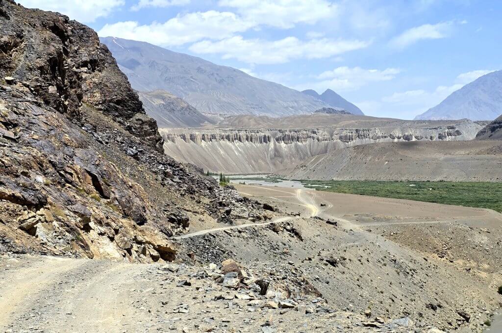
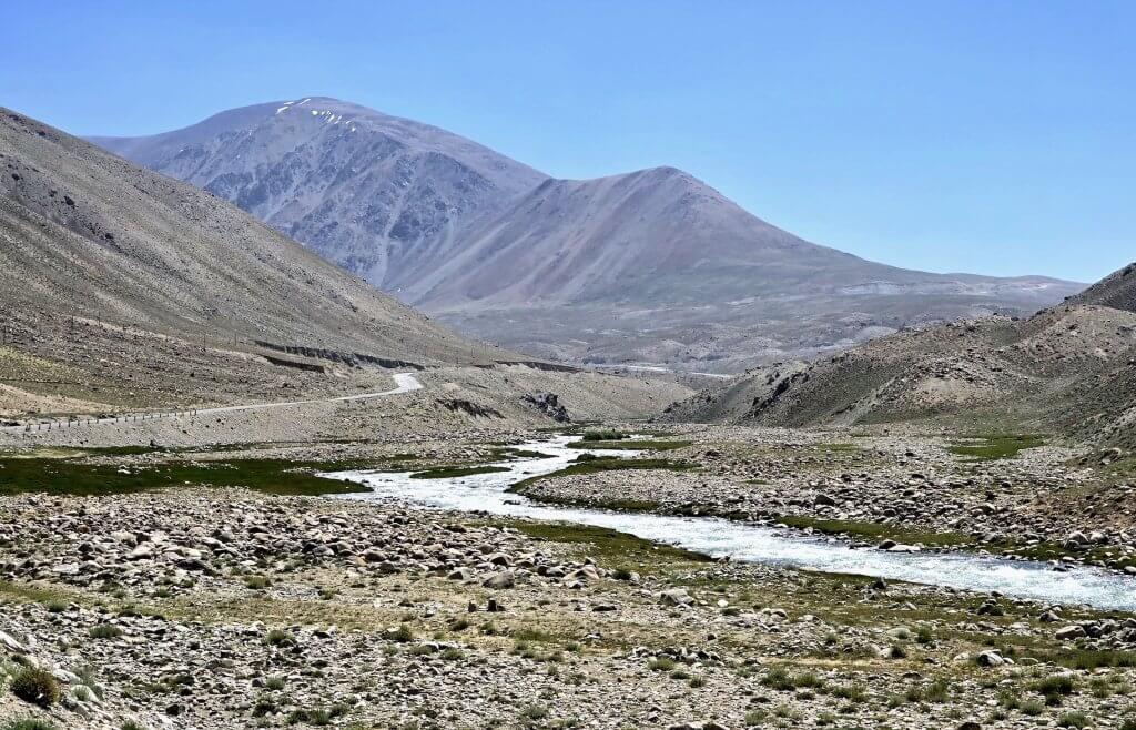
It was never possible to follow the Bartang River all the way to where it becomes the Murghab River anyway. In 1911, a huge earthquake created a natural dam and formed Sarez Lake. This is a huge body of water, about 100km long. At the end of the lake the Bartang River becomes the Murghab River that winds its way out of the high mountains to Murghab town. I had cycled past where the Bartang is dammed (a 30km hike from off the route) so I had already followed the Bartang River as far as possible. The remainder of the route was going to follow a tributary of the Bartang.
Plan B included two days up the Bartang, then return to the Bartang Valley turnoff near Rushan, cycle to Khorog, the main town in the region, and then cycle up the Pamir Highway to the town of Murghab to link up with my original plan from there. This is where I was going to pick up the Murghab River anyway. The distance is only a little further.
Day 100 Bartang Valley turn-off to Khorog – 59km
From the point where I stopped cycling, we decided to drive half way back to Basid – a three hour drive, and then a further three hour drive the next morning to get back to the Bartang Valley turn-off. In that time we noted the river was still rising, so I knew we had made the right decision.
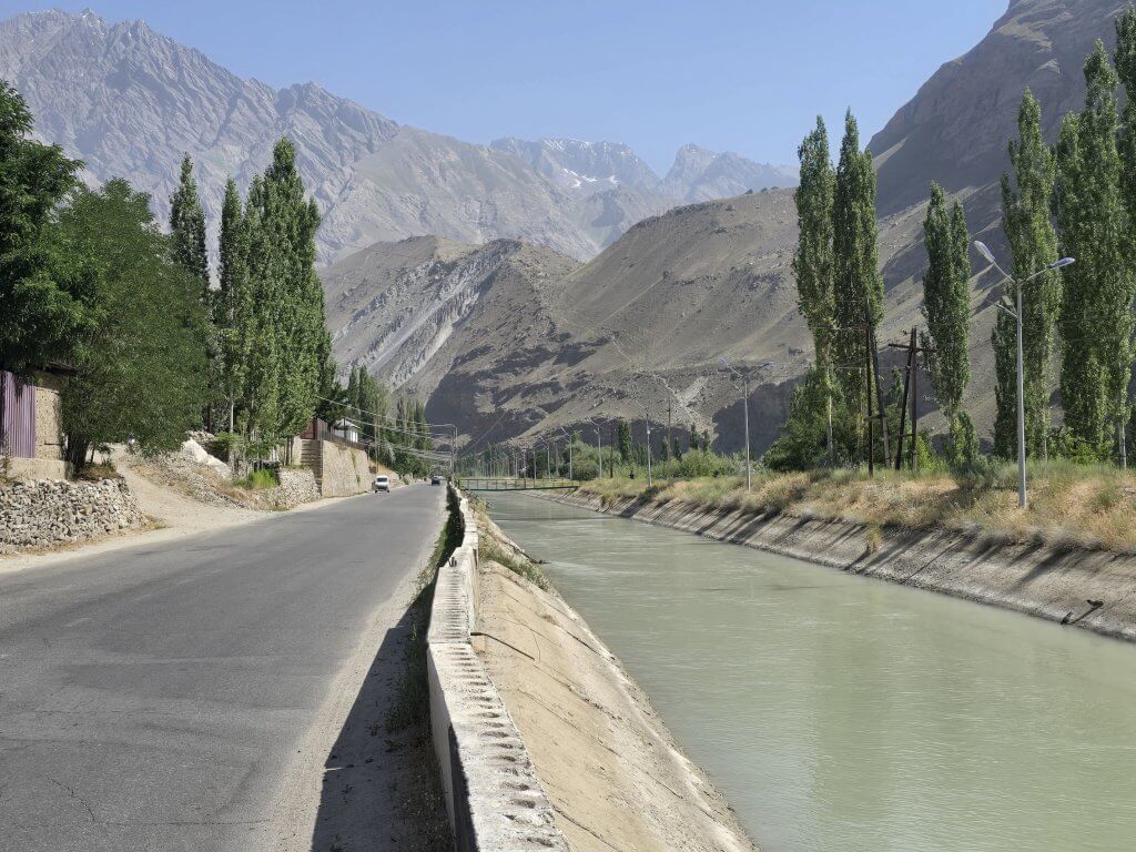
Back on the Panj River, Afghanistan on the right bank. About 45km of the 59km ride was on broken tarmac, similar to the standard of road I had followed before Rushan. The stone enclave is one of the many the Tajikistan military have built in defence of its territory. Tajikistan has had a few conflicts – a civil war in 1992 after the break up of the Soviet Union, and then in 2011 and 2022 there were conflicts to prevent a Muslim extremist invasion
Khorog is a vibrant town a the major centre in the region with more restaurants and shops. We ate at an Uzbek restaurant with a live band playing.
Day 101 Khorog to Jelondy (Hot Springs) – 129km
It is the only continuous route through the difficult terrain of the mountains and is the main supply route to Tajikistan’s Gorno-Badakhshan Autonomous Region. There are a limited number of viable routes through the high Pamir Mountains and the route has been used for millennia. The road formed one link of the ancient Silk Road trade route. It was constructed partly in the end of 19th century (during The Great Game), and mostly in 1930s by the Soviet Union. In 2000s the Pamir Highway was connected with China and Karakoram Highway. The Pamir Highway, (M-41) is known as the international highway with the second highest altitude in the world.
From Khorog I turned away from the Panj River and onto the Pamir Highway towards Murghab. I was feeling a bit pensive because there was a lot of altitude to gain over the next day and a half, from 2086m in Khorog to over 4200m. The only way out of the Panj River valley was up, steeply for the first few kilometres.
On the outskirts of Khorog – the only way is up!
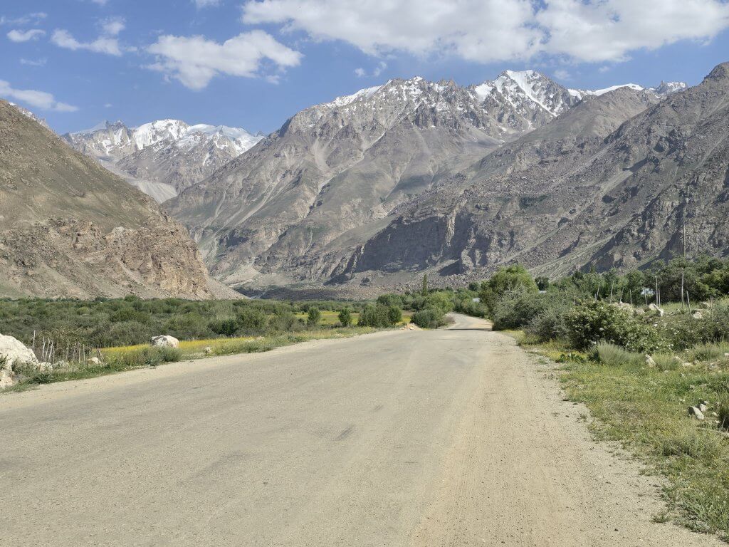
After traversing a series of “open tunnels” I descended sharply to the Gunt River valley and one of several checkpoints along the highway. After that the highway followed the course of the river, gently ascending with some steeper sections. There were a lot of gradients of 2-4% and then some sharper climbs of 6-8%.
A typical scene after 50km (near our lunch stop)
I just tried to keep the pedals turning, averaging 13.2km/hr for the first half of the day, but increased it in the second half of the day. I had planned to stop at a village after 104km, but there was nowhere to stay and Karim said there would be a place at 122km.
The road had been pretty good most of the day, only some broken sections and always potholes. As I ascended the road conditions deteriorated
The day turned into an epic. At 122km there was a truck stop but no place to stay – not Karim’s fault, Google and MapsMe app were incorrectly marked. We eventually came to Jelondy village and a strange place built around some hot springs. I was exhausted but very pleased to have reached this far, to take the pressure off the following day – the big pass was looming. Incidentally I cycled for 9 hours, gained 1889 vertical metres over 129km!
Day 102 Jelondy to Alichur – 85km
Scenery-wise, the morning started as the previous day ended – a stunning high valley, gradually following the stream uphill with a few nasty 8% climbs to waken the tired legs, now filled with lactic acid
Throughout this journey Georgia and Anna have been filming rides for the virtual cycling app and sponsor, ROUVY. I sent Georgia and Karim off up the pass to capture what should be an epic virtual ride for thousands of cyclists to experience (virtually, of course, without experiencing the challenging road surfaces or altitude!) I tried to move steadily, not pushing too hard up the valley.
Finally the pass was in view – you’ll need to look closely – there’s the faint white line of the unsealed road across the mountainNear the base of the climb, a fellow stopped his van and offered me a lift – “No, no, I never take lifts, must cycle the whole way” I think he thought I was mad. Probably am. This was a very difficult – the steepness, totally broken up loose gravel, big stones (as usual around here), huge dirty trucks ascending and descending leaving me enshrouded in clouds of dust and soot. I just kept in the bottom two gears and inched my way up. I wanted to stop but didn’tFinally I made it to what looked like the summit at 4202 m. The team was waiting and we celebrated…but it was one of those false summitsI had done the hard work, but the road continued to slowly ascend to 4284 mStunning scenes all-around!
Here are a few images of the rest of the day
Typical of the terrible surfaces to cycle on
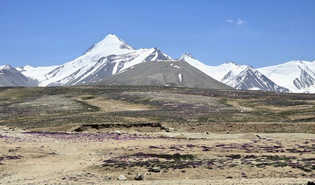
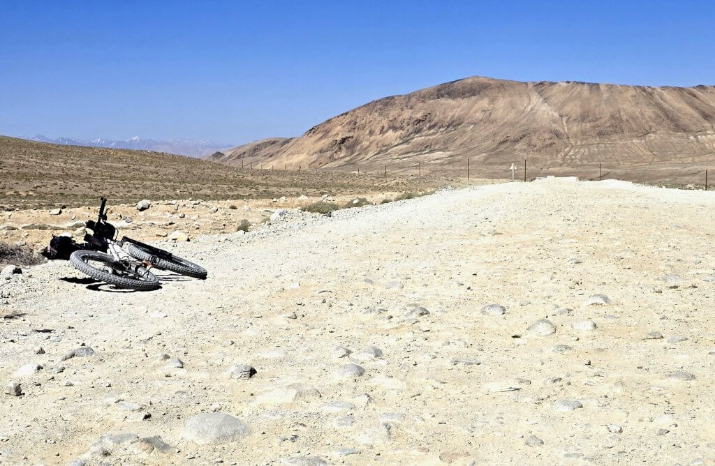
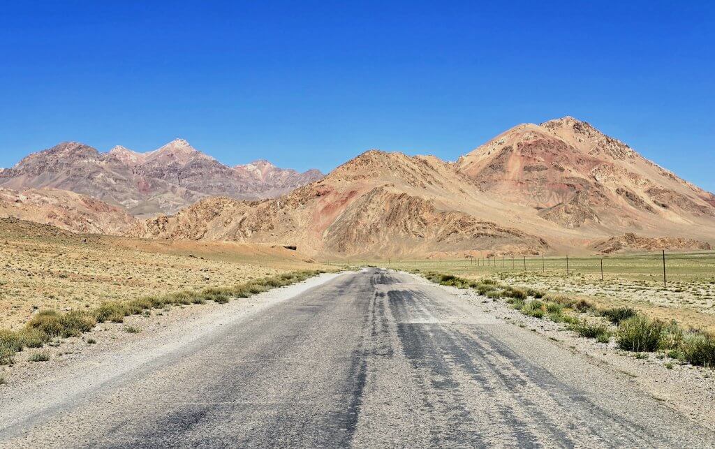
Day 103 Alichur to Murghab 104km
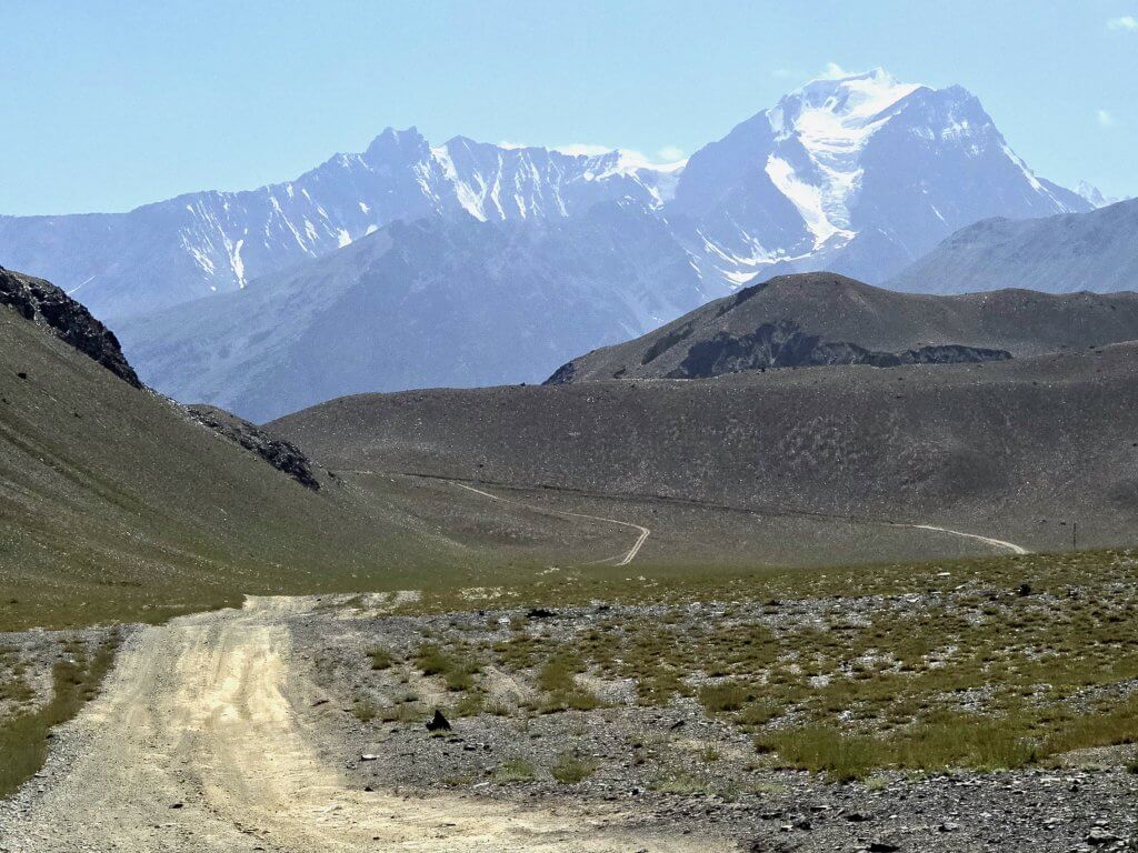
I was now seriously exhausted…my Suunto watch app tells me every day I need 120 hours rest – impossible! The ride tracked the wide valley with beautiful multi-coloured mountains alleviated some of the aches and pains.I gradually ascended from 3800m back up to 4147m. I was really crawling along, until the road started the descend. Murghab is at around 3600m.
Beautiful colours through the mountains
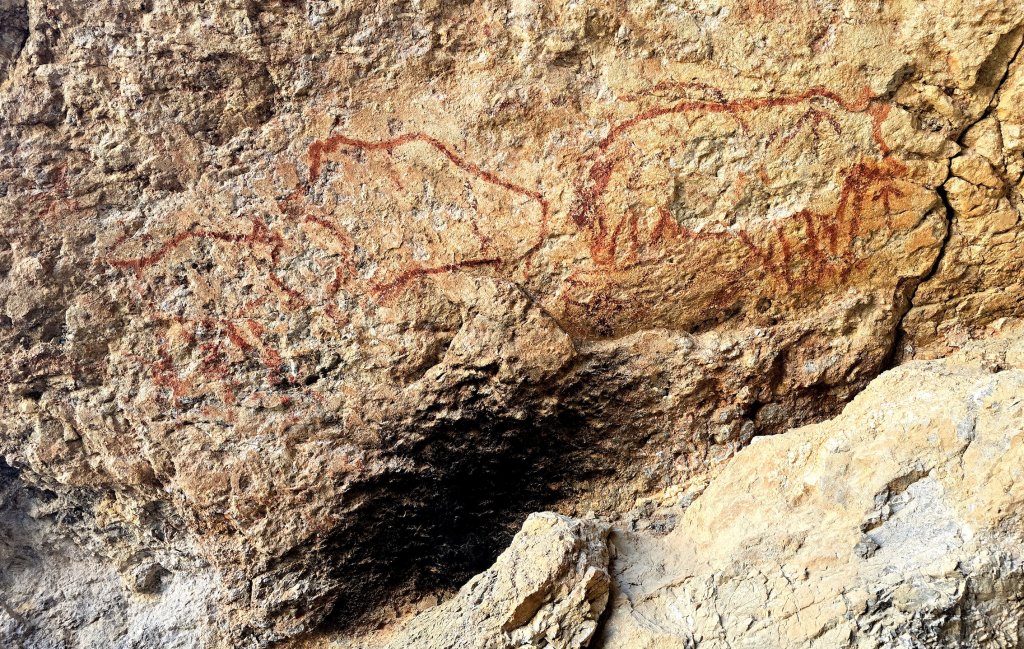
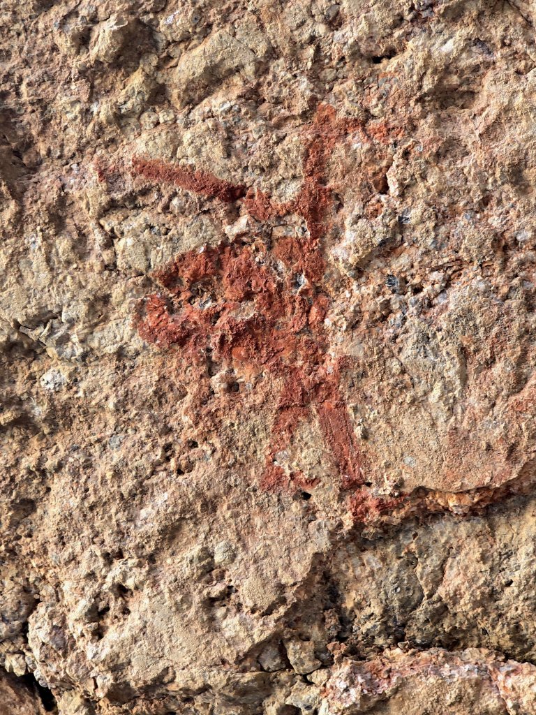
After 72km, we turned off on a side trip to see the Shakhti Cave Drawings, a world heritage listed prehistoric artwork set high above the stunning vast valley.
The Shakhti cave drawings date back tens of thousands of years, probably from the Mesolithic era. They were discovered accidentally by Soviet geologists in the 1950s. The drawings are thought either to be of yaks or hunting bearsThis small image of a man possibly hunting or herding his yaks
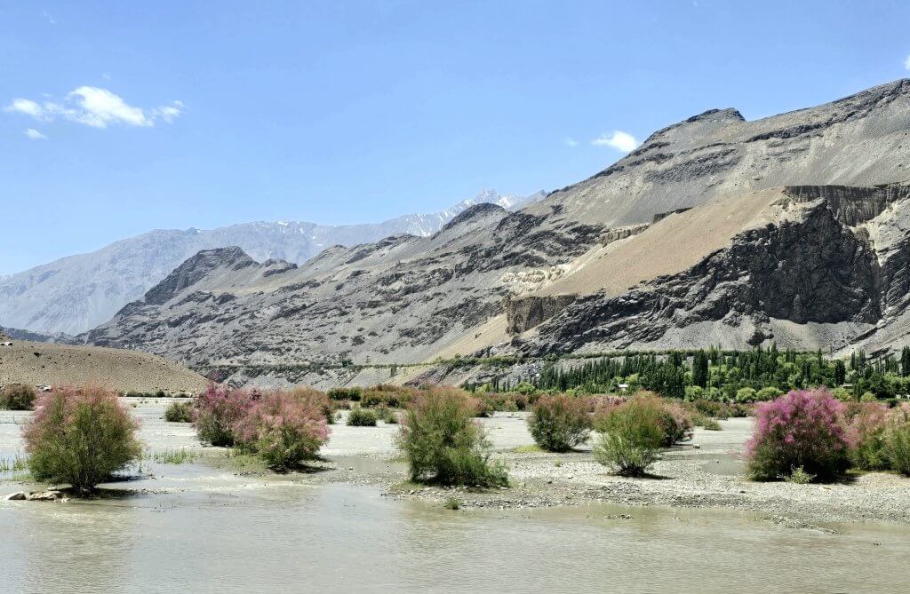
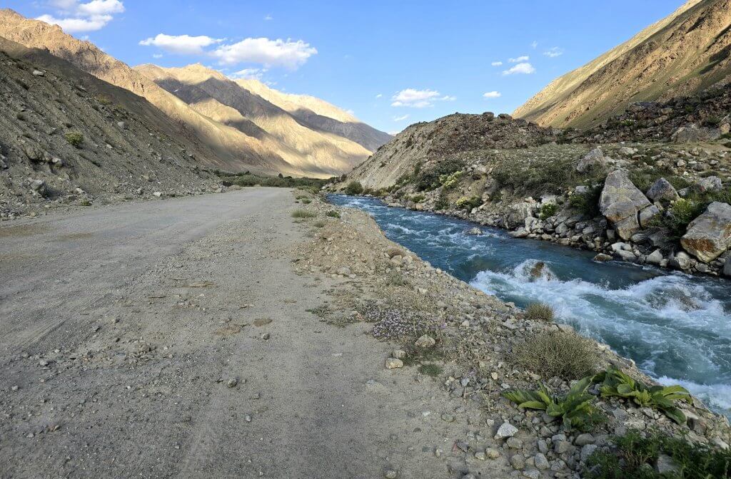
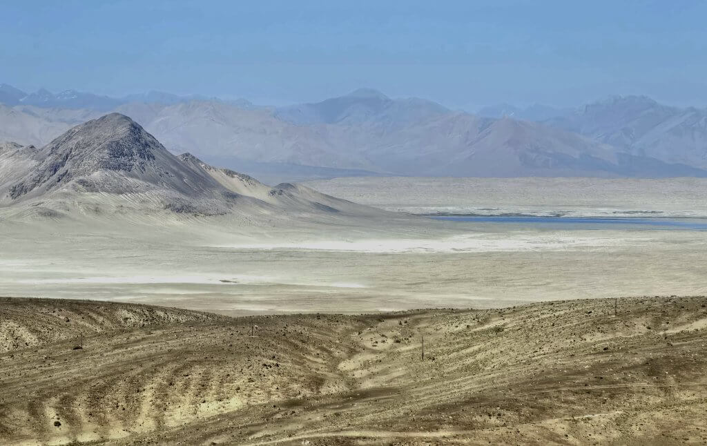
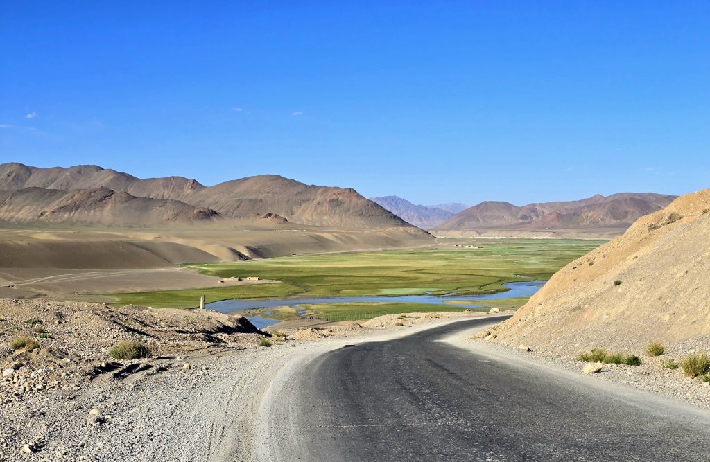
The last 32 km was, apart from a couple of very steep climbs, largely downhill and I made good time. 12 km from Murghab town, I connected with the Murghab River, where it’s great canyon emerges from the mountains.
The Murghab RiverMurghab River valley, looking towards Murghab town
Murghab is like an old frontier town, built by the Soviets as a military base to keep an eye on China, right near the border. They developed the Pamir Highway as the connection to the town. Now the town and the highway service the ever-growing trade between China and Central Asia, particularly Tajikistan. It must be a dificult place to live, freezing in the winter and hot and full of mosquitoes in the summer.
I’m having a much needed day off in Murghab before we head through the back roads to Zorkul Lake, we think a four day ride. It’s very remote which is why I have had to condense the story of the incredible journey over the last week into one long blog entry.
FOLLOW THE JOURNEY
Thanks to ZeroeSixZero, you can open this link on your phone and select “add to home screen” and the map will become and app. You can then keep updated in real time.
TAKE ACTION
Support my Water.org fundraiser to help bring safe drinking water and sanitation to the world: Just $5 (USD) provides someone with safe drinking water or access to sanitation, and every $5 donated to my fundraiser will enter the donor into the Breaking the Cycle Prize Draw.
EDUCATION
An education programme in partnership with Exploring by the Seat of Your Pants, with contributions from The Royal Geographical Society and The Duke of Edinburgh’s International Award Australia. We have created a Story Map resource to anchor the programme where presentations and updates will be added as we go.
Share your love
Kate Leeming
Explorer/adventurer. Kate has cycled a distance greater than twice around the world at the Equator. In the early ’90s when she rode a total of 15,000 km as her way of experiencing Europe, Kate developed her passion for travelling by bicycle. Since then, Kate has stepped it up, performing three major expeditions: the Trans-Siberian Cycle Expedition from St. Petersburg to Vladivostok, the Great Australian Cycle Expedition with Greg Yeoman and the Breaking the Cycle in Africa expedition from Senegal to Somalia. Her next venture is Breaking the Cycle South Pole, which will be the first bicycle crossing of the Antarctic continent via the South Pole. She is preparing for this challenge with expeditions (polar, sand, altitude) on six continents.