13th – 14th August | Sarhad-e-Broghil to Lake Chakmaktin (Little Pamir, Afghanistan) | Distance: 89km |Total Distance: 8970km
Up until 2023, Sarhad was the end of the line, the road stopped there. Accessing the eastern half of the Wakhan Corridor, a region known as the Little Pamir, could only be done on foot, usually with donkeys to carry the load. Two years ago, the Taliban built a gravel road connecting Sarhad to the Chinese border at the eastern extremity of the corridor. It is an ambition of the Taliban and China to eventually reopen the border at the Wakhjir Pass – an ancient trade route that Marco Polo is believed to have travelled on his odyssey to China. My plan was to cycle the route, which traces the course of the Wakhan River, as far as Bozai Gumbaz (69km) and then follow smaller tracks across the high plains of the Little Pamir to Lake Chakmaktin, one of the sources of the Oxus/Amu Darya, where I would finish my cycling expedition. This may only be one and a half days worth of riding, but the section deserves its own blog – it is such a big story.
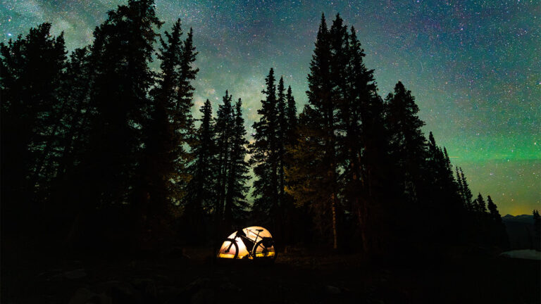
As there are no permanent settlements east of Sarhad, Malang hired a donkey handler with his two donkeys for the trek I planned along the Chelab Stream to search for the true source of the Oxus/Amu Darya at the conclusion of the cycle expedition. The “donkey man” set off before us at 2.30am in order to reach the start point of our trek, about 82km away, in two days time. By comparison, I started pedalling at the leisurely time of 8.30am. Having not had a day off since being in Afghanistan, I was physically tired but mentally I felt fully prepared for the huge challenge ahead.
I set off ahead of the team, cycling through the sparse Sarhad settlement and grassy plains where locals, mostly women and children, were tending to their flocks. On spotting me, children would run towards me, asking for pens and books – but of course I couldn’t help them.
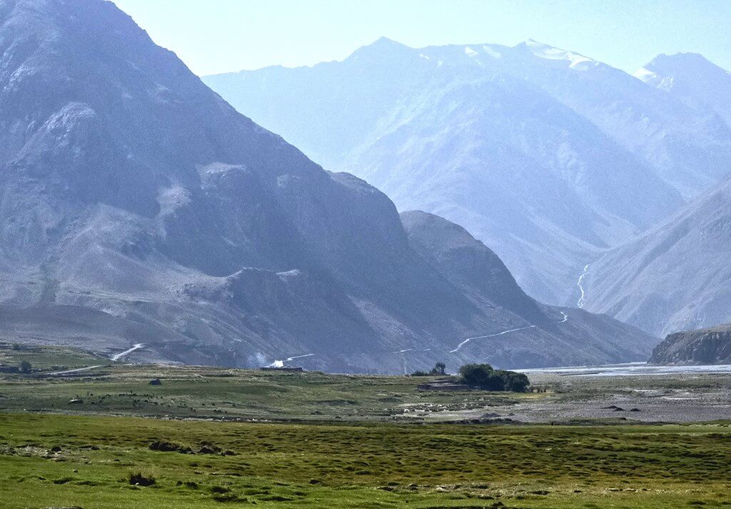
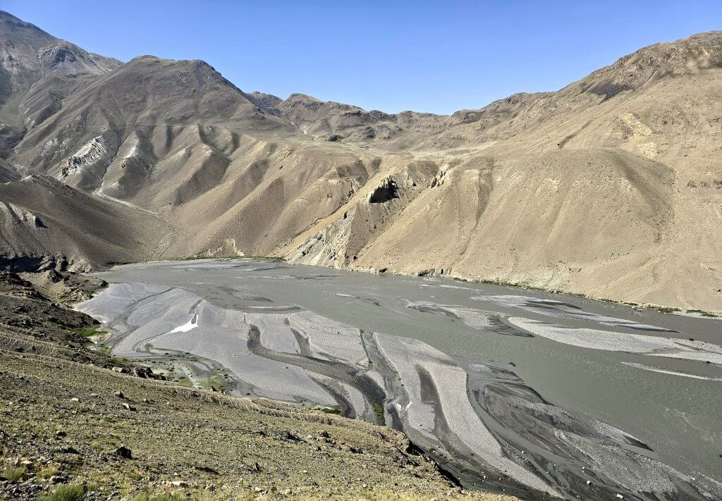
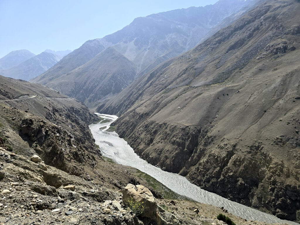
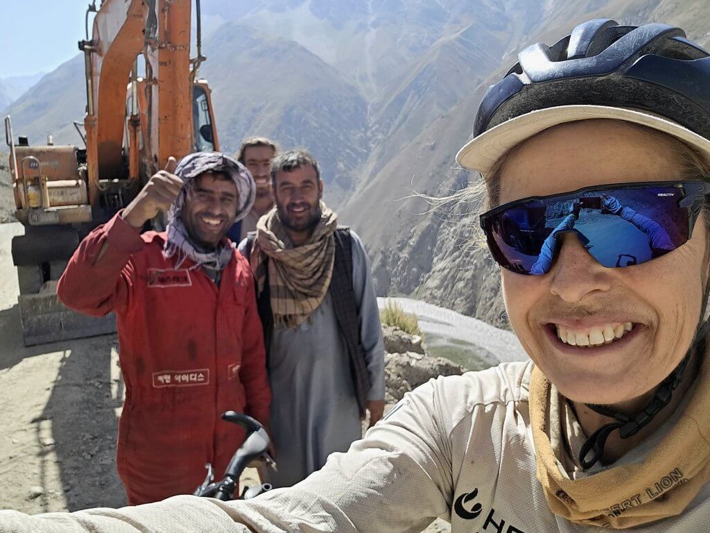
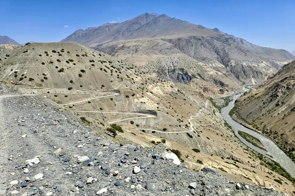
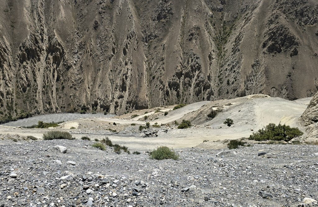
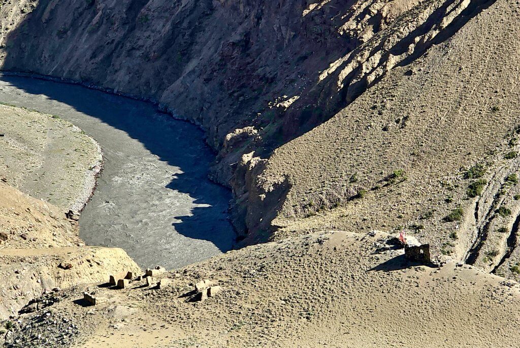
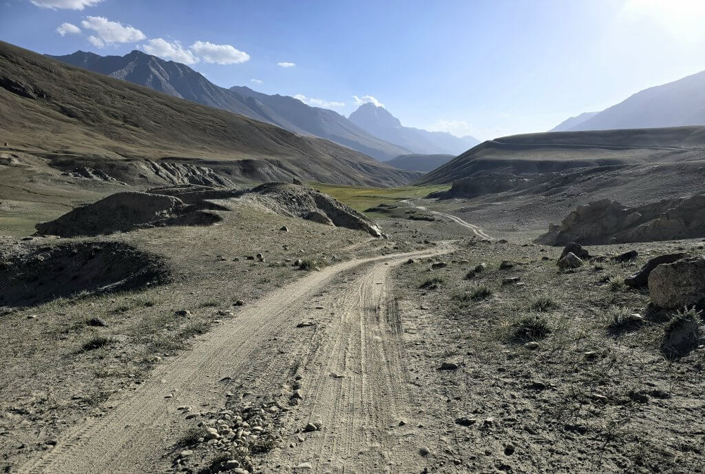
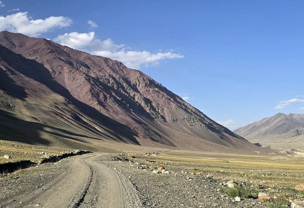
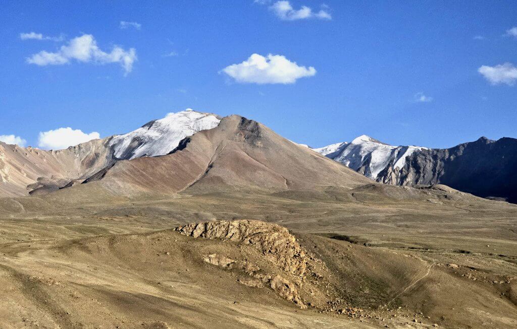
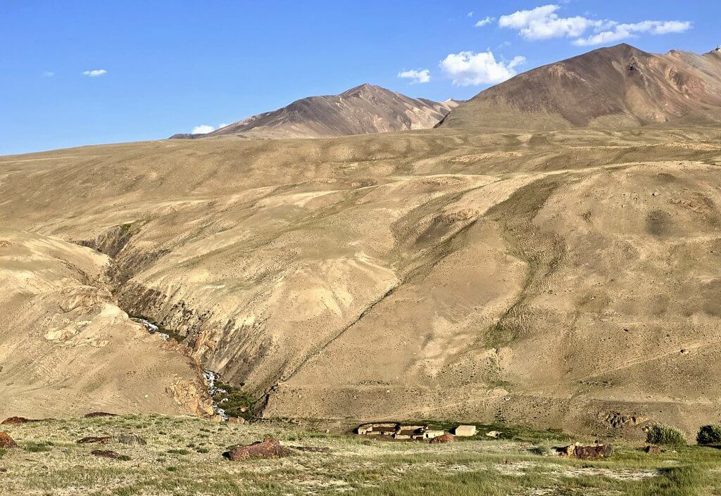
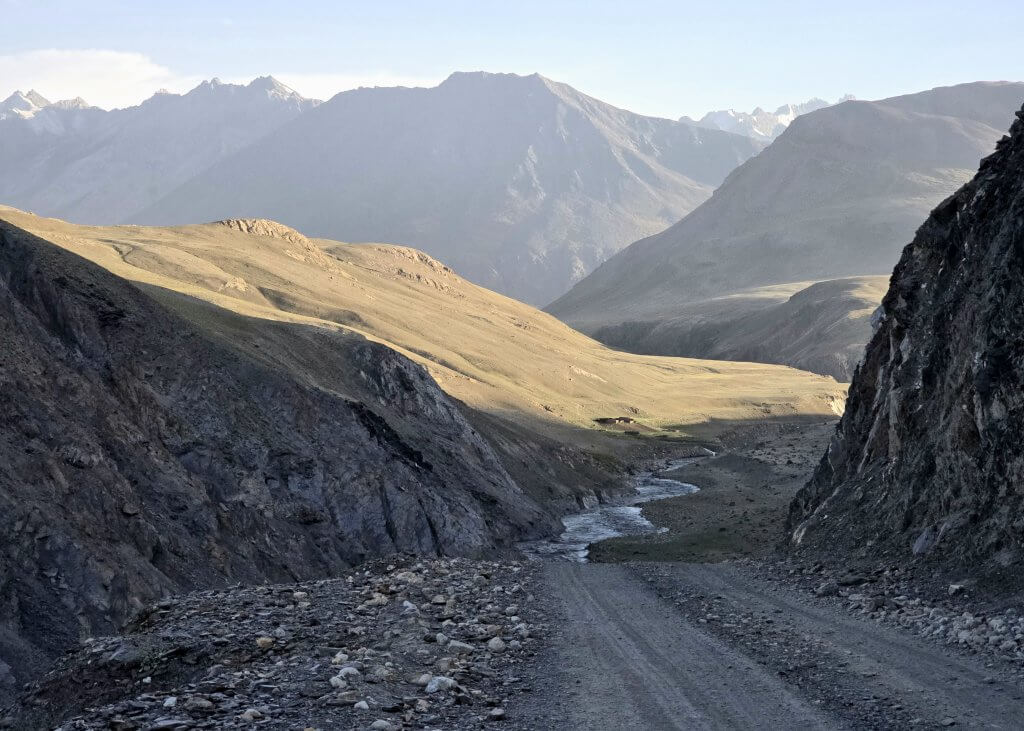
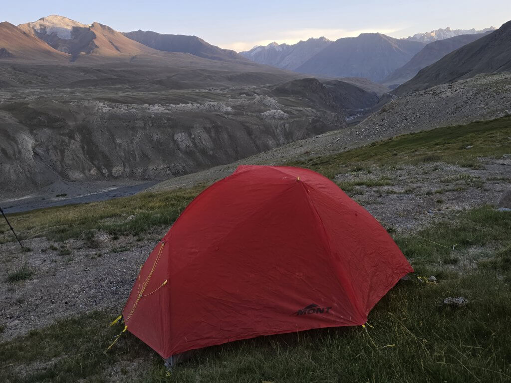
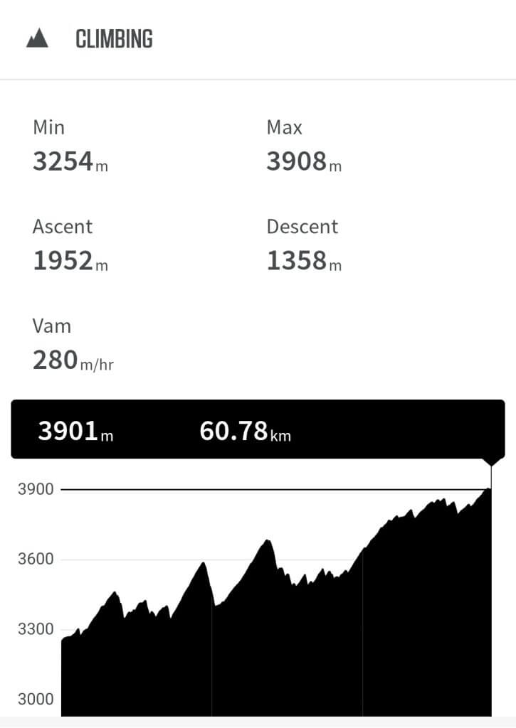
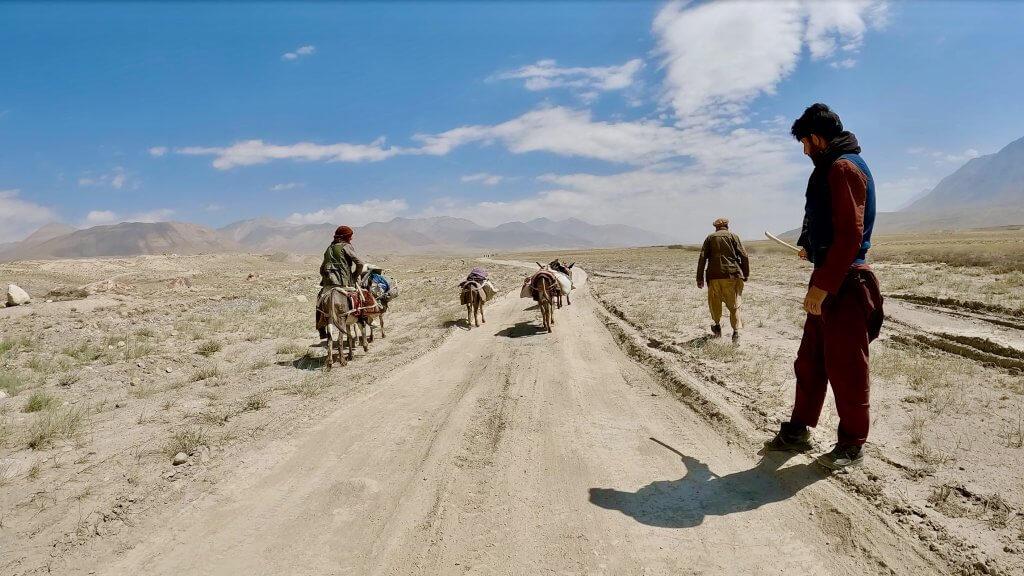
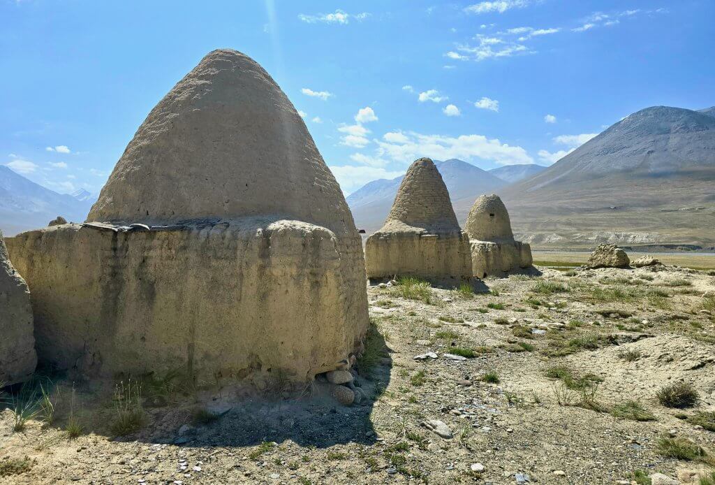
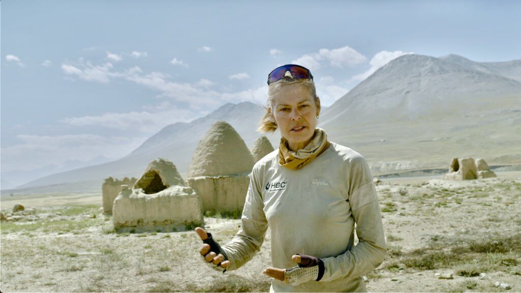
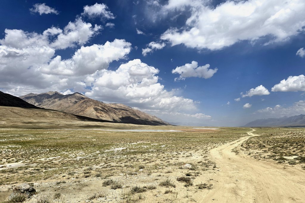
The view of the new road ascending into the mountains above the Wakhan River from the grassy plains near Sarhad.Having ascended, steeply at some points, to the highest point on the previous photo, I was afforded a spectacular view of the Wakhan River with Sarhad in the distance.To the east the broad river valley is constricted into a narrow, steep gorge. The torrent flowing into the broad valley drops some of its silty payload.Due to the steep-sided gorge, the original walking track at this point heads over Daliz Pass (4267m). Engineering the new gravel road that tracks the river has been a huge feat – there is little room for a road wide enough for a vehicle to pass.Engineers are still working on the road, building drainage culverts, shoring up the crumbly banks, repairing landslides, re-aligning parts of the route. This is a wild place and maintaining the road will be a continuous job. The guy in the red overalls was a truck driver who had stopped for a photo – and blocked my path.Glacial streams cascaded down the mountains and into the Wakhan River.Compared to the road between Ishkashim and Sarhad that was built in the 1960s, the new road was generally a better surface with no major water drainage issues, but still incredibly rough due to rockfalls and water damage. Frequented by heavy road building vehicles, it was becoming corrugated and covered with fine bulldust. Building a road through this region required a high level of engineering to negotiate the rugged terrain. There were three passes where the road diverted from the sheer-walled gorge. This was the first climb – Malang called these the “Little Zigzags” implying it was the smaller of the passes. At the base of this descent, he decided we should have an early lunch to give me enough energy to tackle the “Big Zigzags.”The Big Zigzags,” Marpech Pass (3700m) were indeed a big challenge. I pedalled nearly all of it except for a couple of seriously steep sections. The corners were particularly sharp hairpins with extra steep pinches. At one point I was forced to stop for a truck that took four attempts to turn on a difficult hairpin as he descended and still nearly edged me over the cliff.The ruins of adobe huts at Langar, once used as rest stops by shepherds moving their flocks and weary travellers of this ancient Silk Road.This river had entirely washed away a bridge on the new road and the team had to find an alternative – I guess it was the old track. I nearly missed the team who was waiting for me on the other side of the river. The part causeway, part bridge was a nightmare for me to cross because walking on large round stones with hard soled, cleated MTB shoes gives virtually no traction. It was indeed a shocking track – steep, stony and deep bulldust in places. The main road must have been blocked for a while and vehicles had no alternative but to use this diversion.Malang tried to reassure me that, after the Marpech Pass, the landscape would be flatter. But the meaning of flat to a Wakhi person is very different to what flat means to an Australian! There was no flat road, it was a rollercoaster but mostly it was up.As I ascended the valley, the landscape however, did become more open – more like the plains of the Little Pamir. The colours of the mountains were exquisite.Entering the grass-covered highlands, the glaciers were a fraction of what they were a decade ago, according to Malang.Semi-nomadic Kyrgyz people have different camps for the seasons – higher camps to graze their flocks of sheep, goats and yaks in summer, lower in winter.Ascending to Dashti Mirza-Murad Pass (3850m), this was almost the last of the climbs before entering the Little Pamir.We had to find a stream with fresh water, rather than use the Wakhan River water that is full of silt which meant more climbing for my exhausted body…but what a campsite! I was pleased to get this far, only 8km from Bozai Gumbaz, as it meant I could keep to my schedule to reach Lake Chakmaktin, the finish of my cycling expedition. Just 26km to go!Here is what the day looked like on my Wahoo cycle computer. Nearly 2000 vertical metres over 61km!The traditional way to travel to the Little Pamir.300 year old Kyrgyz tombs, one belonging to a leader named Bozai, at Bozai GumbazPresenting to the camera at Bozai Gumbaz
Bozai Gumbaz lies near the confluence of the Wakhjir and Little Pamir or Bozai rivers that join to form the Wakhan River. The road I had been following turns to the south here and along the Wakhjir Valley, gradually ascending over 50km to the Wakhjir Pass at almost 5000m elevation. The pass, that forms the border with China, has been closed since Mao Tse Tung came to power in 1949. Slightly further up the valley is an ice cave with water flowing out of a glacier. The cave was discovered in 1893 by Lord Curzon, at the time the president of the Royal Geographical Society, who gained much publicity for claiming he had discovered the true source of the Oxus. My original plan was to visit the ice cave before finishing my cycling journey at Lake Chakmaktin and therefore visit another source of the Oxus, but the Taliban has closed the region to travellers. I could see construction vehicles heading up the valley, so maybe the road hasn’t been completed. Security is probably another reason why the region is closed to foreigners.
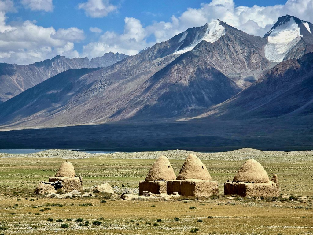
In 1891, near the Bosai Gumbaz tombs, a famous encounter took place between representatives of the three superpowers at the time: Great Britain, Russia and China. It was the height of the Great Game, when the imperial British and Russian empires competed politically for control over Central Asia. British captain and spy, Sir Francis Younghusband, Russian Cossack, Colonel Mikhail Ionov and the British Consul General in Kashgar, Sir George Macartney shared a lavish meal with plenty of vodka, wine and brandy before sparking the so-called Pamir Incident (the Russians expelled Younghusband from what they perceived as their territory), the repercussions of which almost caused a war. Ultimately though, it led to the creation of the Wakhan Corridor as a buffer zone between the two empires, a peaceful outcome that has remained to this day.
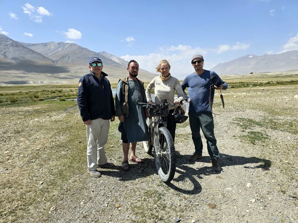
It was great to have Rupert with us for this part of the journey in particular. His passion for the “Roof of the World” and knowledge of the history and geography of the Wakhan Corridor, especially the Little Pamir really helped to heighten a sense of the importance of the region as we travelled through it. To finish my journey at Lake Chakmaktin (another source of the Oxus) and the potential addition of a new chapter in the search for the true source of the Oxus/Amu Darya was very exciting – the whole team was excited.
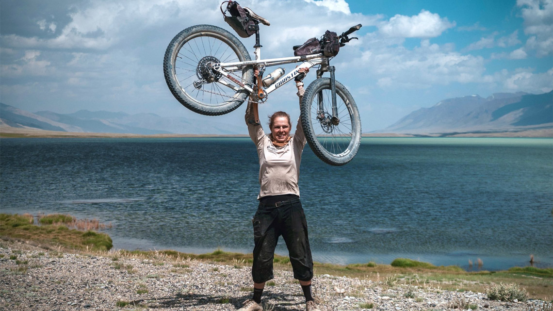
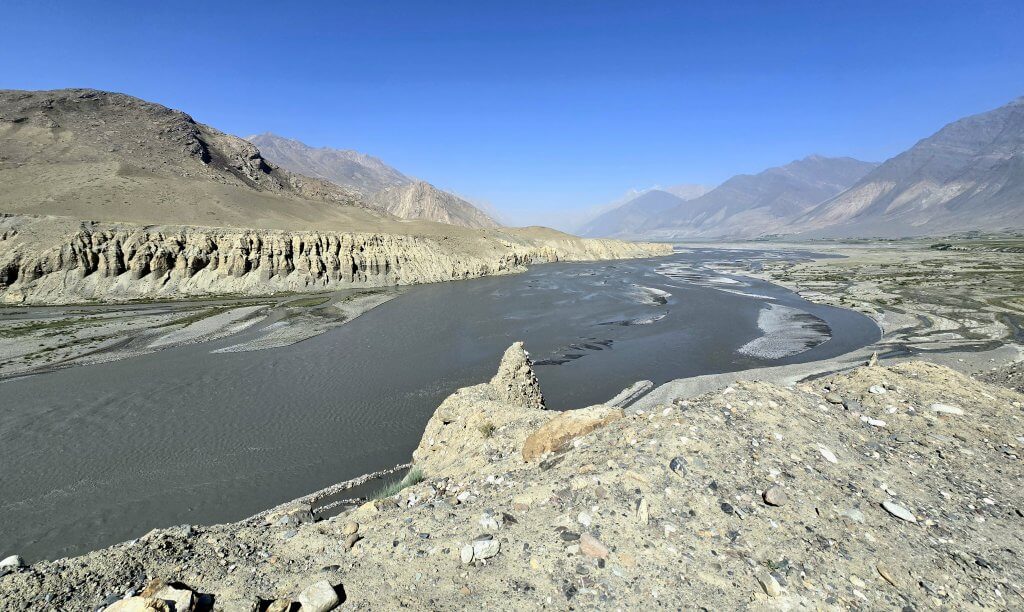
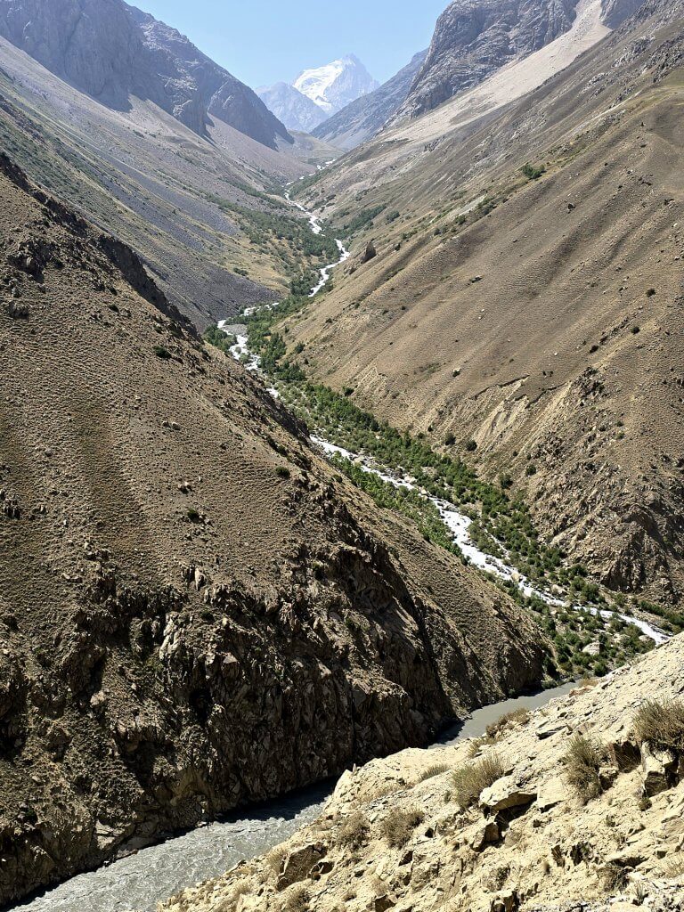
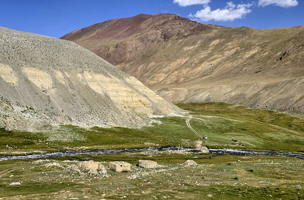
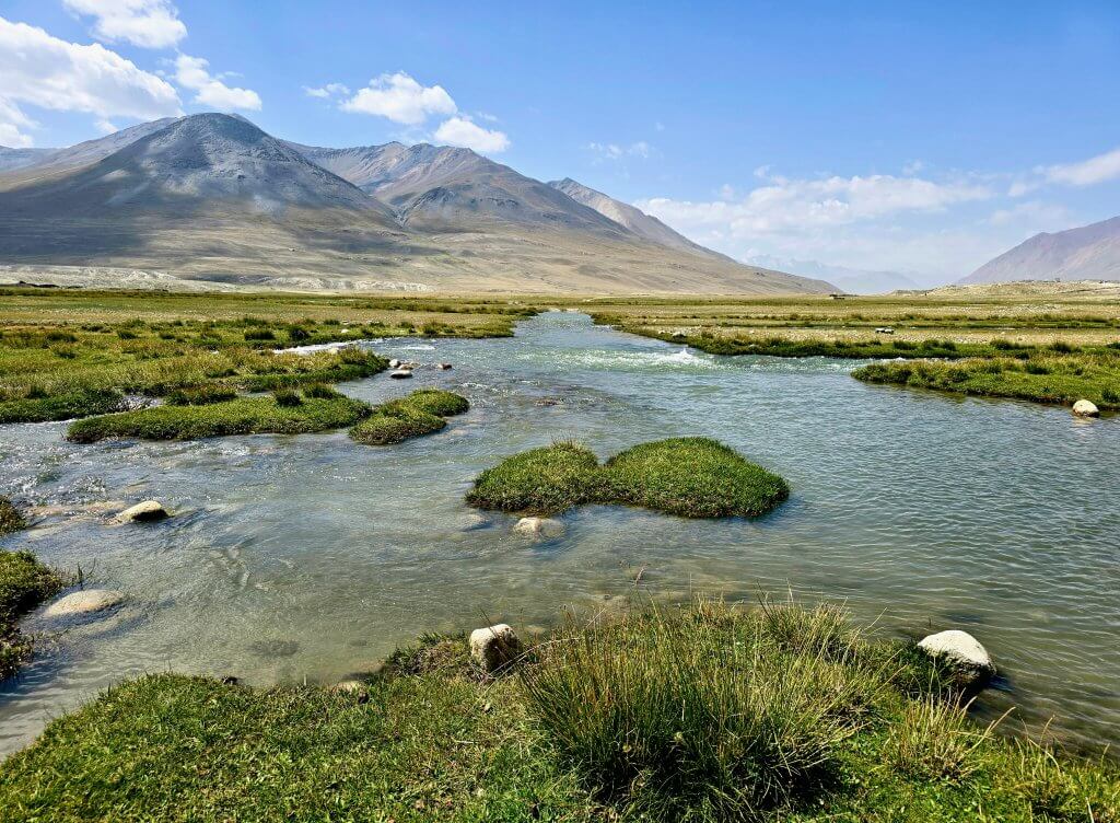
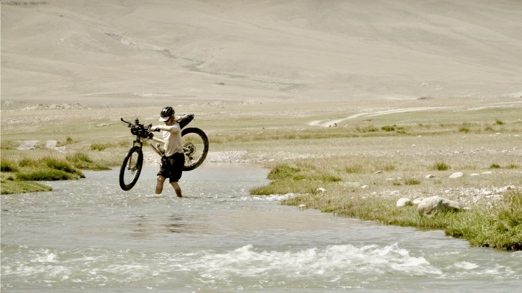
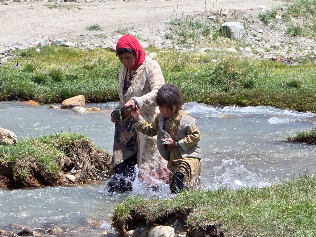
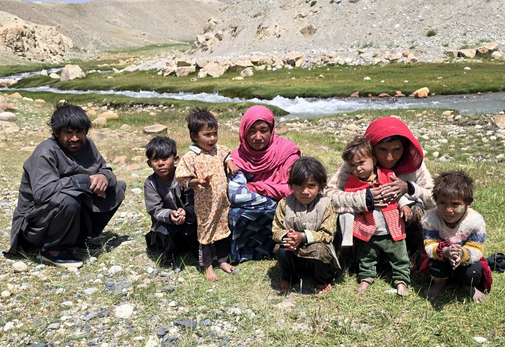
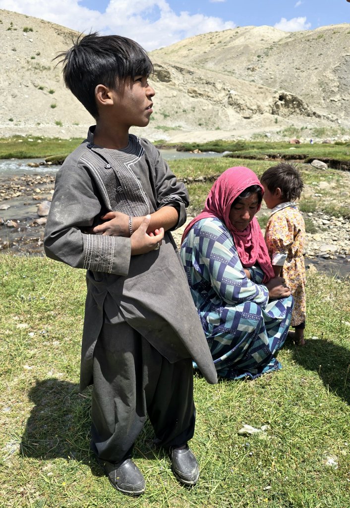
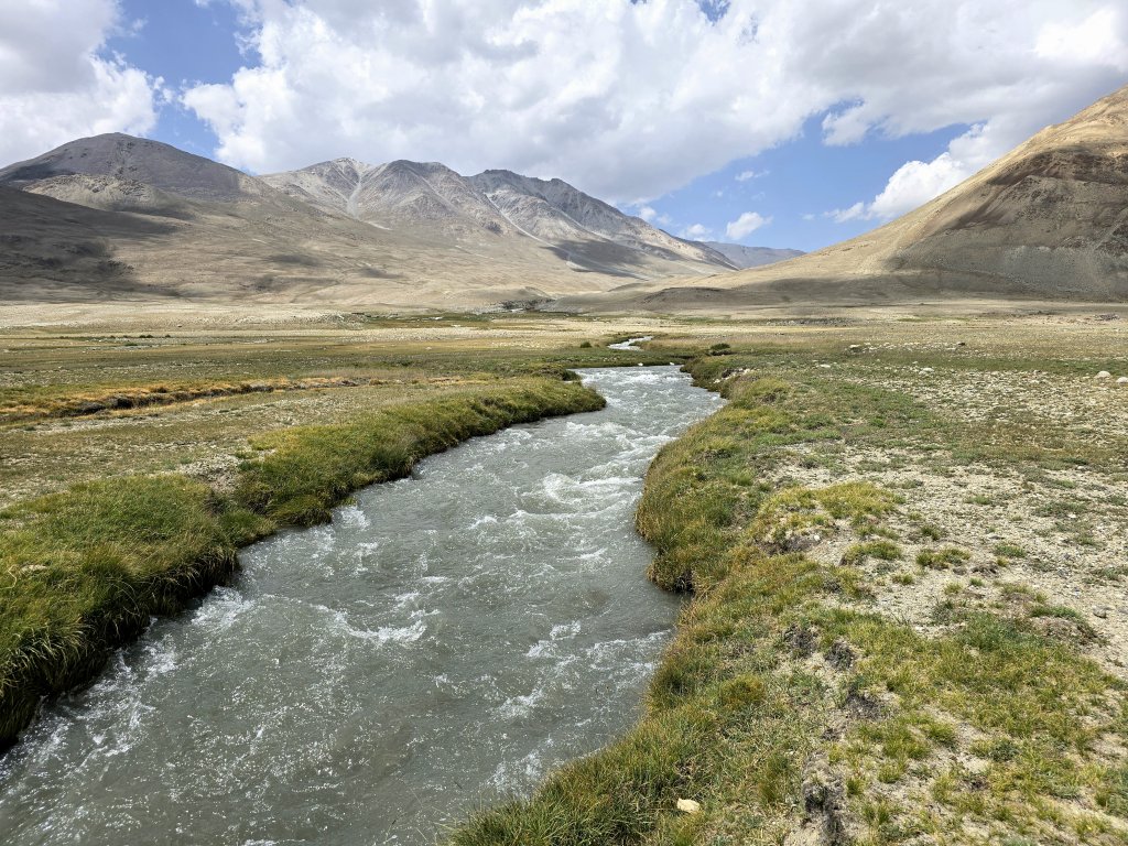
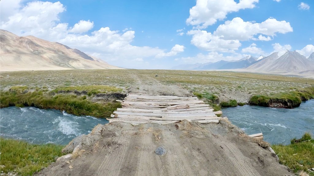
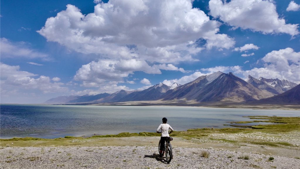
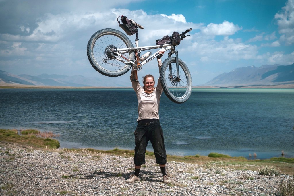
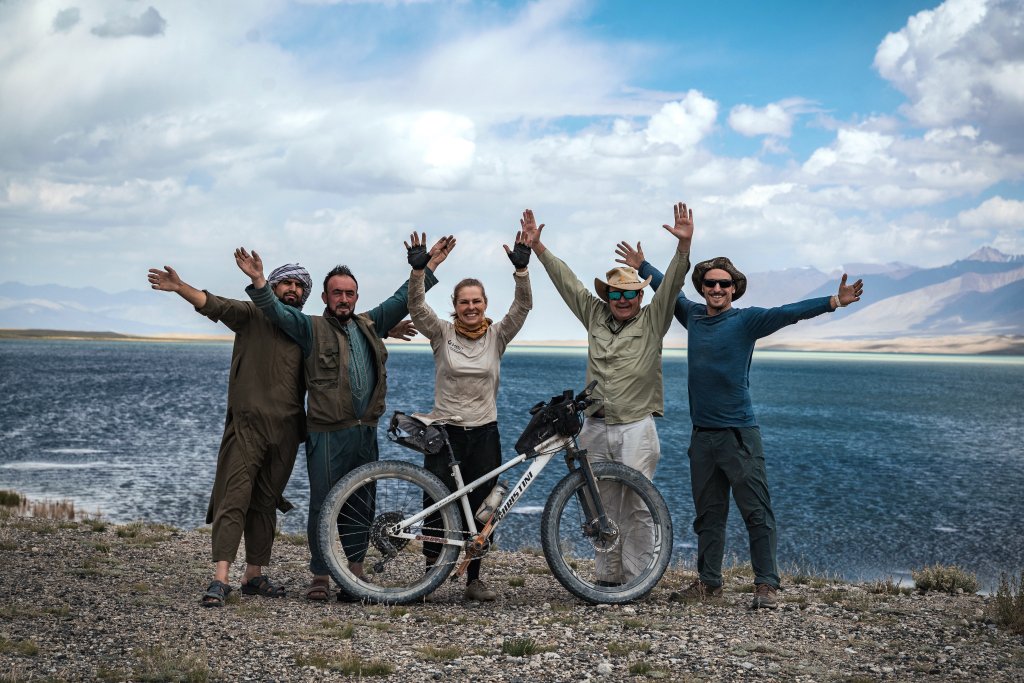
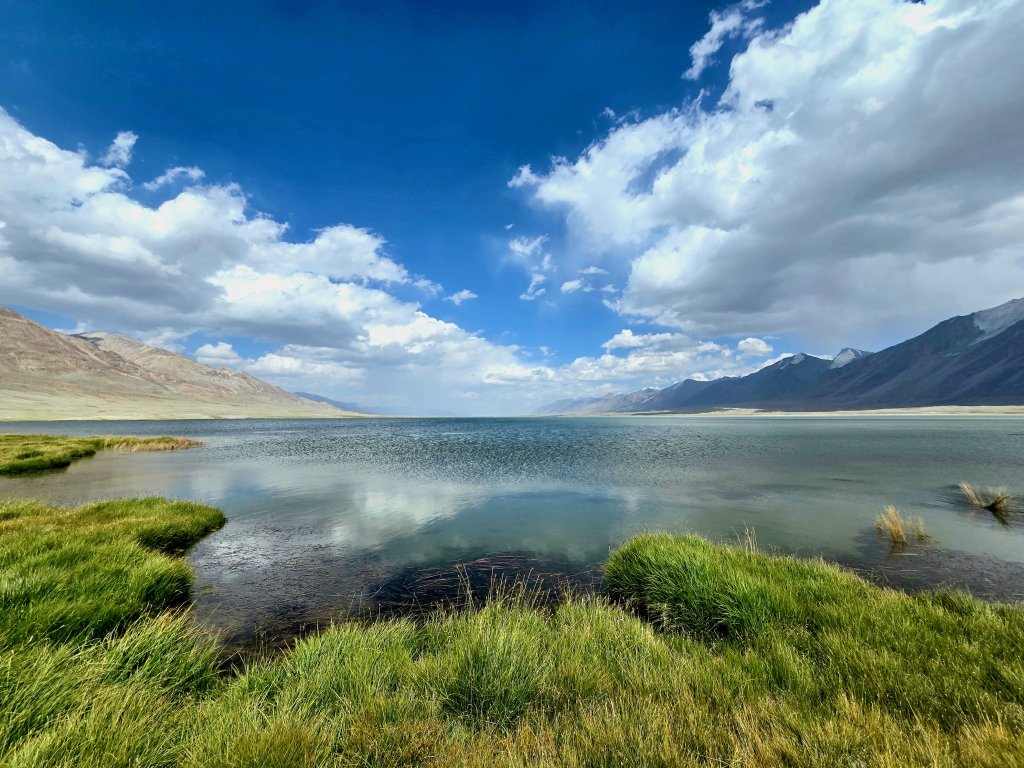
A team photo to celebrate reaching the Little PamirIt is a complex network of streams and rivers that cross the Little Pamir. Water gushes down the high mountains but spreads out once it hits the flat, grassy plain. Streams regularly flowed across the track, sometimes creating deep pools. Eventually the waters drain into the Little Pamir/Bozai River. In the image above, the entire track was inundated for about 200m.On the day coming in to Sarhad, I had to cross a stream of mud and unfortunately the silt worked its way into my sandals and destroyed them. For all of the water crossings in the Little Pamir I had to borrow Malang’s enormous sandals, which were at least 4-5 sizes too big. The oversized sandals were better than bare foot (as I had done a few times on this journey) but I struggled to keep the sandals on each foot and nearly lost a sandal in the streams’ strong current more than once.At the Ajaktash River crossing we came across a Kyrgyz family trying to traverse the braid of fast-flowing streams. The head of the family had two wives, five children and four goats to fit into his car. He was a trader heading to a Kyrgyz settlement near Lake Chakmaktin.The eldest son and the older wife.After a sharp climb away from the river I reached a higher plateau. At this point I had already identified that the Chelab Stream was in next valley (to the left). I had studied the landscape for so long on Google Earth that I found the valley easy to recognise.Looking up the Chelab valley I could just make out where the stream enters the plain and bifurcates. This is the westerly branch of the Chelab that flows into the Little Pamir River, that is then joined by the Wakhjir River at Bozai Gumbaz to become the Wakhan River. The Wakhan River then joins the Pamir River to become the Panj and ultimately, the Oxus/Amu Darya where the Panj is joined by the Vakhsh River. This stream was just shallow enough for me to cycle across it (where it crosses the track) without having to stop and carry my bike.A few hundred metres further on was the eastern branch of the Chelab that flows into Lake Chakmaktin. There were several small tributaries, but this was the main waterway. The stream was significantly larger than the west-flowing tributary and I was relieved to find a small handmade bridge because the water was mush deeper where the track crossed the stream. The vehicle could not use this bridge and traversed the fast-flowing deep stream.About two kilometres on from the larger stream crossing was, to my surprise, a medical clinic recently built by the Aga Khan Foundation to service the nomadic Kyrgyz population. Aga Khan is the spiritual leader of the Ismaili community to which Malang and most Wakhi people belong. Just before the hospital, the Taliban had started to build a mosque. On the lake side of the track was another set of Kyrgyz domed tombs. Here I turned off the track, cycled around the tombs and then cross-country towards the lake. I joined up with the support team about 500 metres later and led them towards the lake and the finish of my 9001km cycle expedition.All sorts of emotions washed over me as I arrived. The stunning location felt spiritual and a fitting end to the journey that had started on the left bank of the Syr Darya in Khujand 149 days earlier, on 24th March.As has become tradition since the Breaking the Cycle in Africa expedition, I lifted the bike above my head in celebration, trying to smile while resisting the strong head wind. (photo: A Dmoch)The team – Abdurahmon, Malang, myself, Rupert and Adrian – was ecstatic too! (photo: A Dmoch)Stunning Lake Chakmaktin!
While the cycle journey had finished, there was still the finale to go – a trek up the Chelab Stream to determine the true source of the Oxus (Amu Darya). Stay tuned for the last blog.
PLEASE TAKE ACTION
THIS IS THE LAST MONTH OF MY CAMPAIGN FOR WATER.ORG. WE HOPE MORE PEOPLE WILL CONTRIBUTE AND GIVE WATER.ORG A BIG BOOST!
Support my Water.org fundraiser to help bring safe drinking water and sanitation to the world: Just $5 (USD) provides someone with safe drinking water or access to sanitation, and every $5 donated to my fundraiser will enter the donor into the Breaking the Cycle Prize Draw.
FOLLOW THE JOURNEY
Thanks to ZeroeSixZero, you can open this link on your phone and select “add to home screen” and the map will become and app. You can then keep updated in real time.
TAKE ACTION
Support my Water.org fundraiser to help bring safe drinking water and sanitation to the world: Just $5 (USD) provides someone with safe drinking water or access to sanitation, and every $5 donated to my fundraiser will enter the donor into the Breaking the Cycle Prize Draw.
EDUCATION
An education programme in partnership with Exploring by the Seat of Your Pants, with contributions from The Royal Geographical Society and The Duke of Edinburgh’s International Award Australia. We have created a Story Map resource to anchor the programme where presentations and updates will be added as we go.
Share your love
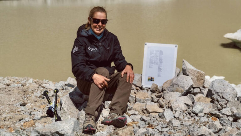
Kate Leeming
Explorer/adventurer. Kate has cycled a distance greater than twice around the world at the Equator. In the early ’90s when she rode a total of 15,000 km as her way of experiencing Europe, Kate developed her passion for travelling by bicycle. Since then, Kate has stepped it up, performing three major expeditions: the Trans-Siberian Cycle Expedition from St. Petersburg to Vladivostok, the Great Australian Cycle Expedition with Greg Yeoman and the Breaking the Cycle in Africa expedition from Senegal to Somalia. Her next venture is Breaking the Cycle South Pole, which will be the first bicycle crossing of the Antarctic continent via the South Pole. She is preparing for this challenge with expeditions (polar, sand, altitude) on six continents.